Synopsis:
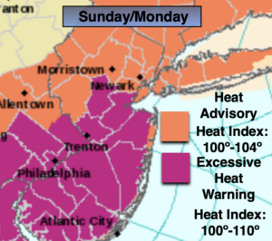
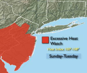
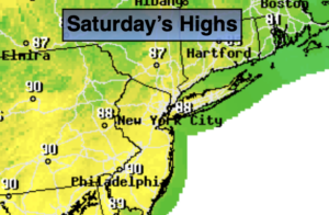
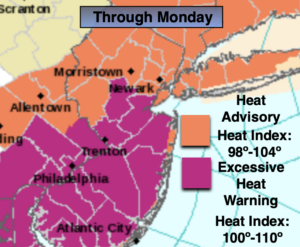
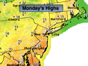
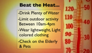
The heatwave will peak today. Readings in highly urban areas will be just shy of 100º. The combination of temperatures in the 90s and high dew points will result in a heat index of 100º-110º today. Heat Advisories and Excessive Heat Warnings have been posted. Hazy sun is expected with just the chance of an isolated storm later today. “Beat the heat” tips are above. Please drink plenty of fluids and listen to your body. If you feel weak take a break.
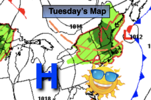
The culprit behind the intense heat is a Bermuda High. The intense bubble of heat will break down tonight and move offshore. Less humid conditions are expected Tuesday with a North wind. It won’t be as hot under mostly sunny skies. Very warm to hot conditions are expected through Wednesday and Thursday. The humidity will also be back as the wind once again blows from the Southwest. True relief from the heat and humidity won’t arrive until Friday with a passage of a cool front.
Stay Tuned.
Keep it here for a no nonsense, no hype forecast.
Today:
Hazy, hot and humid. Isolated afternoon storms. Highs in the mid to upper 90s. Heat Index: 100º-110º. The record high for Central Park is 101 set in 1980. This record will not be in jeopardy. Southwest to West winds at 8-12mph.
Tonight:
Partly cloudy and muggy. Lows in the mid to upper 70s in urban areas, the upper 60s and lower 70s inland. Light Northwest winds.
Tuesday:
Mostly sunny. Not as hot, or humid. Highs around 90º.
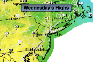
Wednesday:
Hazy, warm and humid. Spotty PM Storms. Highs in the upper 80s.
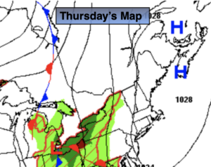
Thursday:
Hazy, hot and humid. Spotty PM Storms. Highs around 90º.
Friday:
Mostly sunny. Less humid. Highs in the mid to upper 80s.