Synopsis:
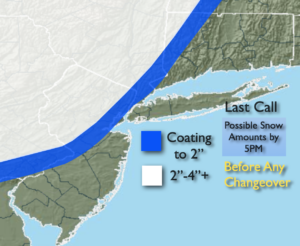
March will come in like a lamb today. Morning rain will give way to partly sunny skies by afternoon. It will be mild. Winds will increase later in the day.
A potent cold front will swing through the region this evening with powerful wind gusts a rapidly falling temperatures.
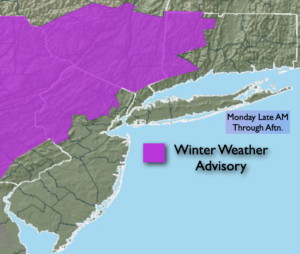
Tonight will be frigid as a brief visiting Arctic airmass moves in. Lows will be in the teens and lower 20s. Winds will gust up to 45mph bringing the wind chills to the single digits.
Cold sun will greet us Tuesday. Readings will be just above freezing for highs and a gusty wind will add a bite.
It will be a rollercoaster ride in temperature. Wednesday and Thursday will be much milder under mainly sunny skies as high pressure moves overhead. Readings will be several degrees above average.
By Friday, another shot of Canadian air will chill the tri-state area with readings remaining in the upper 30s.
There a no major storms of concern in the near future.
Stay Tuned.
Keep it here for a no nonsense, no hype forecast.
Today:
Morning rain. Increasing sunshine during the afternoon. Mild. Becoming windy later in the day. Highs in the lower 50s. Winds becoming Northwest and increasing to 15-25mph during the afternoon.
Tonight:
Mostly clear, windy and frigid. Lows in the lower 20s along the coast, the upper teens inland. Northwest winds at 15-30mph with gusts to 45mph. Wind chills will be in the single digits.
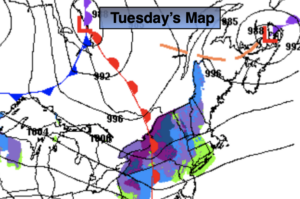
Tuesday:
Mostly sunny and much colder. Windy in the morning. Highs in the mid 30s.
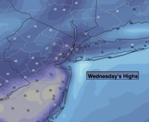
Wednesday:
Sunny, milder. Highs near 50º.
Thursday:
Sunny. Seasonal. Highs in the mid 40s.
Friday:
Partly sunny. Colder. Highs in the upper 30s.