
Synopsis:
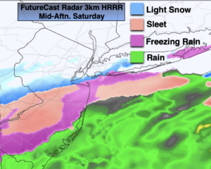
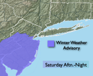
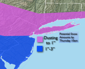
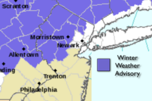
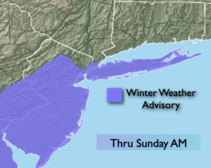
A developing coastal low off the Carolinas will move Northeast and throw on and off light snow, sleet and freezing rain our way overnight. There will not be a lot of precipitation, but it doesn’t take much to cause slick conditions. A light accumulation of sleet and glaze is possible. A Winter Weather Advisory has been posted for the NYC vicinity, Long Island and most of NJ (1st map above).
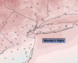
The weak storm will move up and well off the NJ coast by Sunday morning. On and off light sleet, freezing rain and rain will wind down in the early morning. Skies should remain mostly cloudy for Valentine’s Day afternoon and get this- temperatures will get above freezing!
We’ll continue the grey theme for Presidents’ Day. Skies will be cloudy. A bit of light snow, freezing rain and sleet is possible later in the day ahead of the next developing storm to our Southwest. This will be a scattered and light event. Highs will be in the mid 30s.
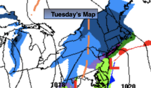
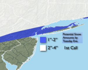
Monday night and Tuesday storm will be more robust. The storm now looks to take a track very close to our coastline. This will result in temperatures getting just above freezing along the coast and near the I-95 corridor. If this holds true, any sleet or freezing rain will go over to plain rain. The track here is key. Arctic high pressure will be to our North. North and West of I-95 and into the inland ‘burbs significant icing is possible with freezing rain. This looks to be a quick mover and should be exiting our region during the afternoon. Late day sun is possible.
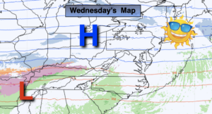
A well deserved brief break will greet us on Wednesday.
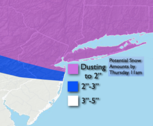
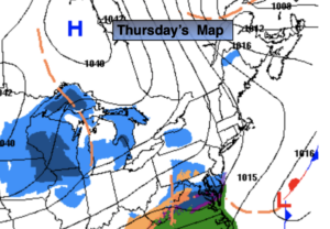
The next storm in this parade will be on Thursday. The potential is there for snow/mix and or rain. This also looks to be a significant precipitation producer.
Stay Tuned.
Keep it here for a no nonsense, no hype forecast.
Tonight:
On and off light snow, sleet, freezing drizzle. Lows in the 20s throughout. Northeast winds at 5mph.
Sunday (Valentine’s Day):
Light early morning mix, rain depending on location. The precipitation will taper off by mid morning and skies will remain mostly cloudy during the afternoon. Highs in the mid 30s.
Monday (Presidents’ Day):
Cloudy with an on and off light mix possible during the afternoon. Highs in the mid 30s.
Tuesday:
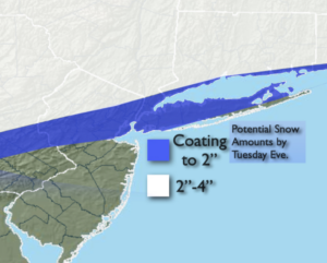
Sleet, freezing rain and rain depending on location. Highs 28º-35º.
Wednesday:
A mix of sun and clouds. Highs in the mid 30s.
Thursday:
Snow, mix, rain potential. Highs in the mid 30s.