Synopsis:
A low pressure system will begin to move in from the South and West today. Clouds will dominate the sky, but some peeks of sun are possible during the morning. Showers will move in by mid to late afternoon. It’ll be cool. The winds will increase and become strong during the afternoon gusting up to 40mph at the coast.
An occluded front associated with the low will move in tonight with a period of heavy rain and high winds. Winds will gust up to 50mph along the coast. Inland winds will be not as strong.
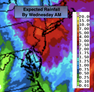
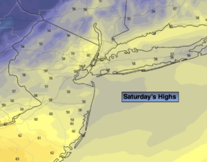
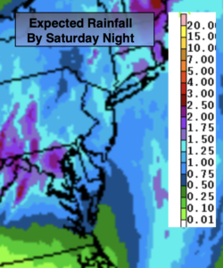
Saturday will feature grey skies with on and off rain as the storm weakens over the region. It’ll be milder with readings a few degrees above the average high of 60º. The rain will end overnight Saturday. One to two inches of rainfall is expected from this system (map above).
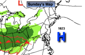
Halloween Sunday will feature a mix of sun and clouds with the possibility of an isolated shower. Temperatures will be comfortable for the trick or treaters!
November’s debut will feature bright and tranquil conditions. Temperatures will cool down into Tuesday.
Keep it here for a no hype-no nonsense forecast.
Stay tuned.
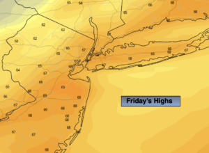
Friday:
Grey skies with afternoon showers developing from South to North. Becoming windy during the afternoon. Highs in the mid to upper 50s. Increasing East winds at 15-30mph with gusts to 45mph by evening along the coast.
Tonight:
Rain, heavy at times. Windy. Lows in the mid 50s in the City, the 40s and 50s inland. East winds at 15-30mph with gusts to 50mph along the coast.
Saturday:
Cloudy with on and off rain. Highs in the lower to mid 60s.
Halloween:
Clouds and sun an isolated shower possible. Highs in the lower 60s.
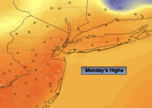
Monday:
Mostly sunny. Highs in the lower 60s.
Tuesday:
Mostly sunny. Cooler. Highs in the mid 50s.