Synopsis:
Rain will continue tonight. Temperatures will actually rise overnight for most regions-possibly getting into the 50s over central and Southern areas. Well inland readings will start off around 40º and then drop into the 30s as a cold front moves into that area.
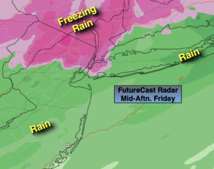
On Friday, the cold front will pass through the region from South to North as low pressure travels along it. Rain will possibly change over to freezing rain (away from the I-95 corridor) inland during the morning. Icing will become an issue on untreated surfaces. Depending on how much cold air bleeds into the system. The potential is there for freezing rain into the NYC vicinity during the afternoon. Here to icing may become an issue as temperatures will plummet on Friday afternoon to around freezing. Central and Southern areas and Eastern Long Island should remain above freezing for most of the afternoon Friday.
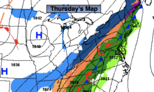
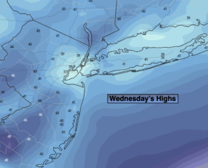
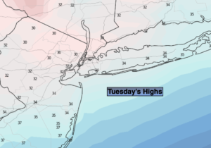
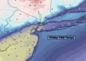
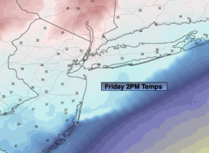
Please take a look at all three maps above. The first two show just how dramatic of a temperature difference there is and how quickly the mercury drops once the front passes through during the midday hours. The last map shows where the potential of freezing rain will occur. Again, it all depends on your local temperature in your location. If you’re at 33º plain rain, 32º it could become quite icy. You get the idea here.
There will be a hard freeze Friday night under clearing skies. Any standing water will become ice.
Saturday will feature another bitter blast with readings below freezing. At least the sun will be shining as Arctic high pressure dominates.
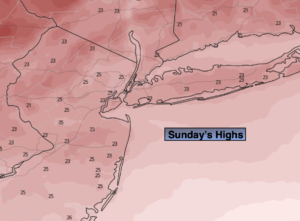
On Sunday, readings in urban areas may crack freezing with a mix of sun and clouds as high pressure begins to move off the coast.
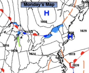
Monday will be quite pleasant for early February with readings near 40º under bright skies.
A storm will be to our South on Tuesday and should not affect the region. Partly sunny skies are expected with readings a few degrees above the average high of 38º.
Stay tuned.
Tonight:
Periods of rain. Lows in the 40s then falling into the 30s inland. Temperatures may rise through the 40s and possibly into the 50s over central and Southern areas. Southwest winds at 5-10mph.
Friday:
Rain along the coast, possibly changing to freezing rain. Freezing rain inland. Turning colder. Temperatures falling through the 40s and to near freezing during mid afternoon in urban areas. Temperatures falling into the 20s North and West. North winds at 5-10mph.
Saturday:
Mostly sunny, breezy and much colder. Highs in the upper 20s.
Sunday:
Partly sunny. Highs in the lower 30s.
Monday:
Partly sunny. Highs around 40º.
Tuesday:
Partly sunny. Highs in the lower 40s.