Synopsis:
High pressure will slip off the coast today. A mix of sun and clouds is expected with readings near the seasonal average of around 50º in the City. It’ll be cooler by the coast and Long Island and warmer over much of NJ.
Clouds will increase and thicken tonight. Spotty light rain is possible late.
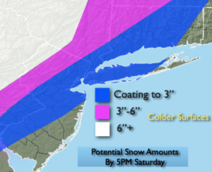
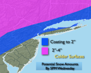
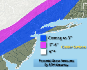
On Saturday a potent cold front will move toward the East coast. At the same time a storm will develop over Eastern North Carolina and intensify rapidly as it move up and just off the coast. Rain will develop early Saturday morning in all areas. The front will move through as the storm gets to our latitude during the midday and afternoon hours. A close eye will be kept on the backend of the storm. The potential has increased that the rain will change over to a period of snow before ending, this will most likely occur inland. An accumulation is possible and potential snow amounts are above. This is a very tricky forecast. Please stay tuned.
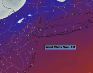
Very strong winds will develop in the wake of the storm Saturday afternoon and Saturday night into Sunday morning. Gusts over 50mph are likely.
Saturday night we Spring Ahead. Don’t forget to move your clock ahead one hour. Eastern Standard Time ends at 2am and Daylight Saving Time resumes. It’s also a good time to change the batteries in your smoke and carbon monoxide detectors.
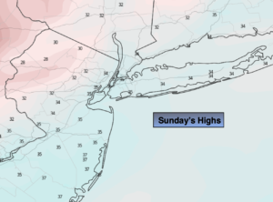
Sunday will be bright, windy and cold readings will at least ten degrees below the average high of 48º. Yes, it’s still Winter. But, lets look on the bright side; we will gain an hour of daylight during the evening!
It’ll be a better feel for the beginning of the week with bright, mild conditions making a visit.
Spring officially arrives on March 20th and it couldn’t come any sooner.
Stay tuned.
Keep it here for a no hype, no nonsense forecast.
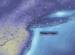
Friday:
Partly sunny. Highs around 50º in the City, the 40s at the coast and over Long Island, the lower to mid 50s over parts of NJ.
Tonight:
Increasing and thickening clouds. Spotty light rain possible late. Lows in the lower to mid 40s in the City, the 30s inland. Light Southeast winds.
Saturday:
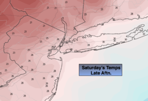
Rain changing to snow inland during the late morning. A possible changeover in the NYC vicinity by early afternoon. Highs in the 40s. Temperatures will fall during the day. Becoming windy.
Sunday:
Partly sunny, windy and cold. Highs in the mid to upper 30s.
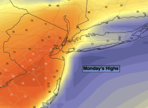
Monday:
Mostly sunny. Milder. Highs in the mid 50s.
Tuesday:
Partly sunny. Mild. Highs around 60º.