Synopsis:
Friday will be a winner with plenty of sun and seasonable readings as high pressure builds into the region. The average high is in the lower 80s.
The first weekend of Summer will be a memorable one. Abundant sunshine and warm readings are expected as high pressure moves over the region and into the Atlantic. A noticeable increase in humidity will be felt by Sunday.
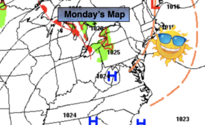
Scattered showers and storms are likely Monday with a the passage of a cool front.
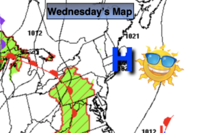
Tuesday will be a beauty with near average readings and low humidity as high pressure moves in from the Great Lakes.
Stay tuned.
Keep it here for a no hype, no nonsense forecast.
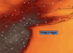
Friday:
Sunny. Highs in the around 80º. Cooler over Eastern Long Island. Northwest to South winds at 5-10mph.
Tonight:
Clear. Lows in the upper 60s in the City, the upper 50s and 60s inland. West to South winds less than 5mph.
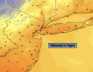
Saturday:
Sunny. Highs in the upper 80s.
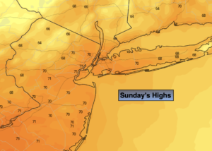
Sunday:
Mostly sunny, hot and more humid. Highs around 90º.
Monday:
Mostly cloudy. Scattered showers and storms. Humid. Highs around 80º.
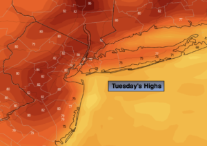
Tuesday:
Sunny. Less humid. Highs around 80º.
Catch me on the Fox Weather Stream from 10am-1pm Friday. Find us on Tubi, Roku TV and YouTube TV and as always the Fox Weather App. It’s Free!