Synopsis:
Our gorgeous weather will continue today. Temperatures will be near the average high of 83º with low levels of humidity as high pressure settles along the Mid-Atlantic coast. Picture perfect!
As the high shifts offshore a Southwesterly wind will take hold on Thursday and Friday (which is the first of July!) This will result in a rise in temperatures under a bright sky. It’ll be come hot and humid as we greet the new month.
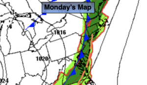
The 4th of July weekend will start off steamy. An approaching cool front will spark showers and storms on Saturday. We’ll fine tune the timing as we get closer.
Relief will arrive on Sunday as the front pushes offshore. Morning showers are possible but the sun should return during the day.
A peek at the 4th of July forecast will make most smile. Sunny skies, warm temperatures and low humidity is expected!
Stay tuned.
Keep it here for a no hype, no nonsense forecast.
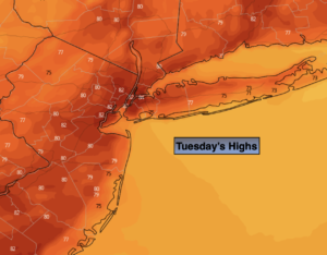
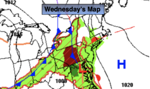
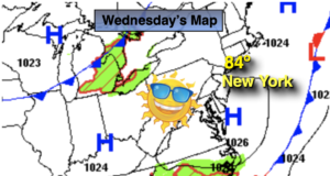
Wednesday:
Sunny. Highs in the lower to mid 80s. West to South winds at 5-10mph.
Tonight:
Clear. Lows in the upper 60s in the City, the upper 50s and 60s inland. Southwest to West at 5mph.
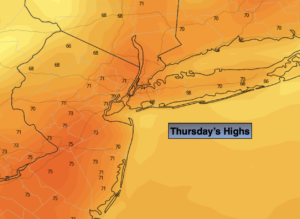
Thursday:
Sunny. Warmer. Highs in the upper 80s.
Friday:
Sunny, hot and humid. Highs in the lower 90s.
Saturday:
Hazy, hot and humid. Chance of showers and storms. Highs around 90º.
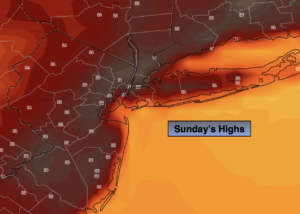
Sunday:
Morning showers possible. Afternoon sun. Not as hot or humid. Highs in the mid 80s.
Catch me on the Fox Weather Stream from 10am to 1pm Wednesday. I will be live for the Macy’s fireworks prep. Find us on Tubi, Roku TV and YouTube TV and as always the Fox Weather App. It’s Free!