Synopsis:
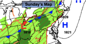
Low pressure will move from the Ohio Valley to the Northeast the next 48 hours. Labor Day will not be a loss with the weather. As stated the last few days, there will be peeks of sun. Most of the showers will hold off until later in the afternoon or evening. Well to the North and West scattered showers are possible throughout the day. I’m keeping the majority of the day dry for 90% of the area.
A Flood Watch has been posted for the entire tri-state area through Tuesday. One to four inches of rain is possible. Flooding of streets, highways, streams and rivers are possible. Never drive through a flooded roadway you don’t know how deep that water is. Turn around, Don’t drown.
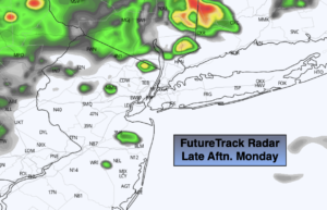
Tonight periods of rain will develop. Some of the rain will be torrential at times.
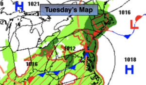
Heading back to work and school on Tuesday you’ll need an umbrella and some patience heading out the door as the front slowly pushes over the region. On and off rain is in the forecast and it’ll be quite cool. Again, some of the rain will be locally heavy.
Low pressure will be stubborn to move offshore Wednesday. It may remain mostly cloudy with a showers possible, especially in the morning.
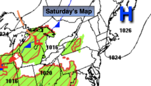
It’ll be a brighter Thursday and Friday with high pressure finally taking control from the North.
Keep it here for a no hype, no nonsense forecast.
Labor Day:
The clouds will win the battle today but the majority of the day will be dry (except for areas well North and West where scattered showers are likely. Scattered showers are likely toward evening for the rest of the region. Highs in the upper 70s to lower 80s. Humid. East to Southeast winds at 5-10mph.
Tonight:
Periods of rain, locally heavy at times. Chance of a thunderstorm. Lows in the 60s throughout. Southeast to South winds at 5mph.
Tuesday:
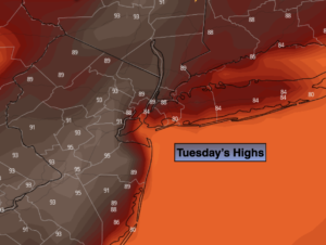
Periods of rain. Locally heavy at times. Chance of a thunderstorm. Much cooler. Highs in the lower 70s.
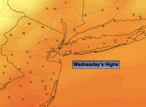
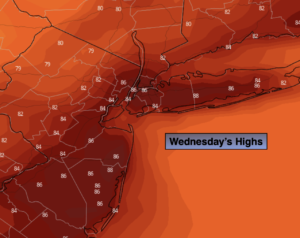
Wednesday:
Mostly cloudy. Morning showers possible. Highs in the lower to mid 70s.
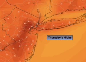
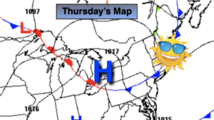
Thursday:
Mostly sunny. Highs in the upper 70s.
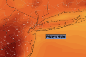
Friday:
Sunny. Highs around 80º.
Catch me Labor Day on the Fox Weather Stream from 1p-4p. Find us on Tubi, Roku TV and YouTube TV and as always the Fox Weather App. It’s Free!