Synopsis:
Today- September’s debut, through the middle of the Labor Day weekend looks fantastic as high pressure continues to dominate. The sun will rule the sky and temperatures will be comfortably warm with low levels of humidity. Readings will be around the average high of 81º. Sunday’s temperatures will warm into the mid 80s.
Readings at night will be quite comfortable, in fact a taste of fall will greet the inland ‘burbs the next two nights.
Sunday night and Labor Day a cool front will approach. Scattered showers and storms are in the forecast for this time frame but it will not be a washout.
Keep it here for a no hype, no nonsense forecast.
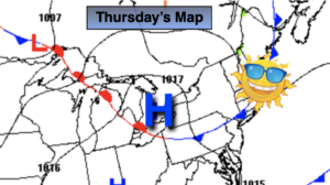
Thursday:
Sunny. Highs in the lower to mid 80s. Northwest winds at 8-12mph.
Tonight:
Clear and much cooler than recent nights. Lows in the lower 60s in urban areas, the 40s & 50s North and West. North to Northeast winds at 5mph.
Friday:
Sunny. Highs around 80º.
Saturday:
Sunny. Highs in the lower 80s.
Sunday:
Partly sunny. Highs in the mid 80s.
Labor Day:
More clouds than sun. Scattered showers and storms. Highs in the upper
Catch me Thursday on the Fox Weather Stream from 4pm-7pm. Find us on Tubi, Roku TV and YouTube TV and as always the Fox Weather App. It’s Free!