Synopsis:
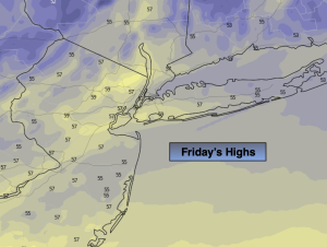
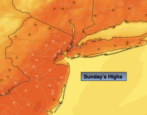
Indian Summer will be with us through Monday. High pressure well off the coast will continue to pump up warm air from the South. Our early June feel goes on. Temperatures will be well above the average highs of the upper 50s (some areas by nearly twenty degrees). This will result in record high temperatures for many locations. The record high for Central Park today is 74º set in 2015. This will be in jeopardy. More clouds are in the forecast for Sunday as a weak disturbance moves in. Spotty showers can’t be ruled out, but much of the time will be dry.
The forecast through Monday will be a familiar one with warm readings. A cool front will move through by midday. An isolated shower is possible during the morning, otherwise skies will be mainly sunny.
A Canadian airmass will move in for Tuesday and Wednesday bringing our temperatures more closer to average as November says hello again. It will be a shock as we’ve been dealing with Spring-like conditions. The sun will continue to dominate.
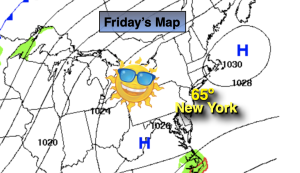
Thursday will feature above average temperatures as we get on the milder side of the high.
Eastern Standard Time has resumed. The sun will set this afternoon at 4:46pm. Yep, darker earlier.
Stay tuned.
Keep it here for a no hype, no nonsense forecast.
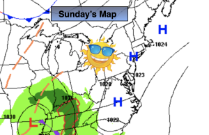
Sunday:
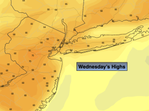
More clouds than sun. Spot shower possible. Record warmth for most areas. Highs in the mid 70s. South winds at 8-12mph.
Tonight:
Mostly cloudy. Spotty showers possible late. Lows in the 60s throughout. These readings are warmer than the average high for the day! Southwest winds 5-10mph.
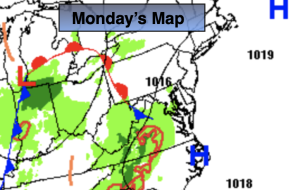
Monday:
Isolated morning shower, otherwise becoming sunny. Warm. Highs in the mid 70s.
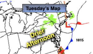
Tuesday:
Sunny. Cooler. Highs in the mid 50s.
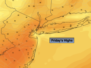
Wednesday:
Sunny. Cool. Highs in the mid 50s.
Thursday:
Sunny. Milder. Highs in the mid 60s.