Synopsis:
A cool front will approach today. Mainly cloudy skies are expected with scattered showers. The heaviest rain looks to hold off until later this afternoon and evening. An isolated thunderstorm is possible at that time. It’ll be mild with readings a few degrees above the average high of 66º.
Showers and isolated storms are likely for the first half of the night. Some of the rain maybe heavy at times as the front pushes offshore.
Friday will be sunny and mild as high pressure builds in from the South and West.
It’ll be a fine fall weekend for leaf peeping or pumpkin pickin’. Abundant sunshine is expected with mild temperatures as the high moves out into the Atlantic to our South.
Low pressure will develop over the Northeast on Monday. Showers are likely at this time.
Keep it here for a no hype, no nonsense forecast.
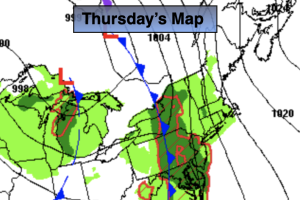
Thursday:
Mostly cloudy with scattered showers. Breezy. Some of the showers will contain heavy rainfall later today. Isolated storms are also possible toward evening. Mild. Highs around 70º. Southeast winds at 10-15mph with gusts to 30mph.
Tonight:
Scattered showers and isolated storms early. Locally heavy rain is possible. Lows in the upper 50s in urban areas, the 40s inland. South to Northwest winds at 8-12mph.
Friday:
Sunny. Highs in the upper 60s.
Saturday:
Sunny. Highs in the upper 60s.
Sunday:
Mostly sunny. Highs in the upper 60s.
Monday:
Mostly cloudy with scattered showers. Highs in the mid 60s.