Synopsis:
Today will be the pick day of the next five. Abundant sunshine and mild readings are anticipated as high pressure dominates.
On Thursday, low pressure will track from the Southern plains to the Eastern Great Lakes. Clouds will thicken during the morning. On and off showers are likely with balmy readings during the afternoon.
Friday will feature mostly cloudy skies and guess what? Mild temperatures. We’ll be in between systems.
The front will push offshore Friday night. A couple of areas of low pressure will develop along the front to the South for the weekend. The first wave will push offshore Saturday morning sparring the area any rainfall. A mix of sun and clouds is anticipated for the beginning of the weekend. Sunday’s low will be more robust developing in the vicinity of the Carolina’s, but this to looks to push out to sea resulting in more clouds than sun for Sunday. Both days readings will be a few degrees above the average high of 40º.
Stay tuned.
Keep it here for a no hype, no nonsense forecast.
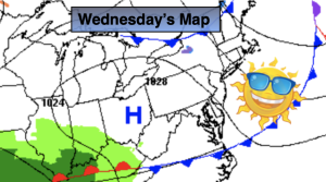
Wednesday:
Mostly sunny. Highs in the lower 50s. West to Northwest winds at 8-15mph.
Tonight:
Clear early, becoming partly cloudy late. Lows in the mid 30s along the urban corridor,, the 20s & 30s inland. Light winds.
Thursday:
Mostly cloudy with on and off showers during the afternoon. Mild. Highs in the lower 50s.
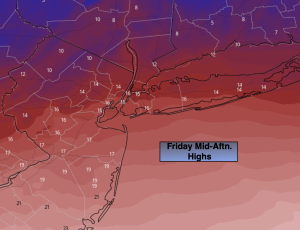
Friday:
Mostly cloudy. Mild. Highs in the upper 50s.
Saturday:
Sun and clouds. Cooler. Highs in the mid 40s.
Sunday:
More clouds than sun. Highs in the lower to mid 40s.