Synopsis:
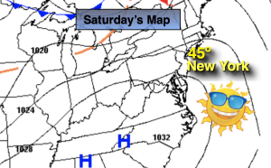
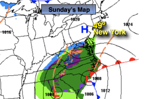
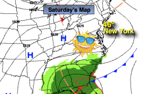
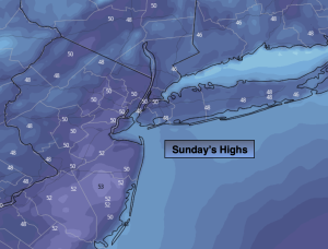
The short-lived chill has departed the area. High pressure will now become our mild weather maker as it moves offshore and the warmer return flow greet us for the second half of the weekend. A mix of sun and clouds is expected for Sunday with readings five to seven degrees above the average high of the lower 40s.
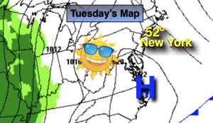
On Presidents’ Day temperatures will once again reach early Spring readings ahead of an approaching weakening cool front under as mix of sun and clouds. Tuesday will be no different with above average readings continuing with a chance of afternoon showers as a weak disturbance to the North skirts our region.
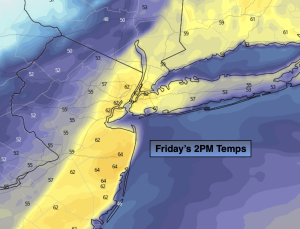
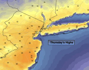
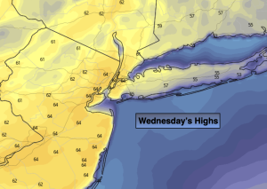
A storm will develop over the mid-section of the country for the second half of the week. The track of the low will (like all its predecessors) move well to our North and West. This is a warm solution. A warm front associated with the storm will move our way later Wednesday with rain. Morning showers on Thursday should give way to a some sun with mild readings.
Stay tuned.
Keep it here for a no hype, no nonsense forecast.
Sunday:
Partly sunny, mild. High around 50º. South winds at 8-12mph.
Tonight:
Mostly clear, milder than recent nights. Lows in the mid 40s in the City, the 30ss inland. Southwest winds at 5mph.
Presidents’ Day:
Partly sunny, mild. High in the mid 50s.
Tuesday:
More clouds than sun. Chance of afternoon showers. High in the upper 40s to lower 50s.
Wednesday:
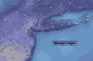
Any morning sun giving way to thickening clouds and afternoon rain. Cooler. High in the lower 40s.
Thursday:
Morning showers giving way to some afternoon sun. Milder. High in the 50s.