Synopsis:
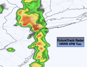
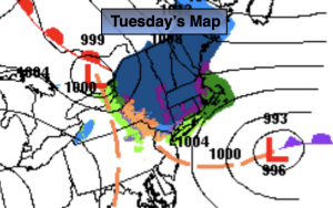
Areas of light rain, drizzle and very light snow to the North will continue into the first half of today and then taper off as the storm moves farther offshore. Clouds will hang tough.
Skies will clear tonight with the urban corridor getting down to around freezing. Inland areas will experience a hard freeze.
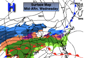
The sun will return for a brief break on Wednesday as high pressure says a quick hello.
A weak low will move through the region on Thursday morning with scattered showers. The sun will return with readings well above average- a Spring feel once again for sure.
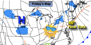
The next storm is on the map for Friday. The exact track (like always) will determine the type of precipitation. As of this writing the storm will take an inland track-a warm solution. Mainly rain is expected with any mix North and West going over to rain. This system looks to carry with it copious amounts of precipitation into Friday night as a secondary storm develops over our region.
Skies will remaining mostly cloudy on Saturday but it will be rain-free as the system pulls into the Atlantic.
Stay tuned.
Keep it here for a no hype, no nonsense forecast.
Tuesday:
Areas of light rain, drizzle and light snow depending on location will taper off during the day. Skies will remain mostly cloudy. Highs will range from the upper 30s to mid 40s. Northeast to Northwest winds at 8-15mph and diminishing some during the afternoon.
Tonight:
Clearing skies. Lows near freezing in the City, the upper teens and 20s inland. Northwest winds at 5mph.
Wednesday:
Sun to clouds. Highs mid 40s.
Thursday:
Morning showers to sunshine. Much warmer. High well into the 50s.
Friday:
Rain. A mix to rain possible well North and West. Highs in the 30s and 40s.
Saturday:
Clouds. Some late day sun. Highs in the lower 40s.