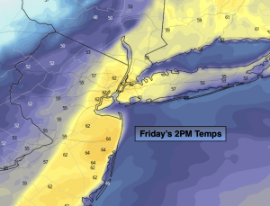
Synopsis:
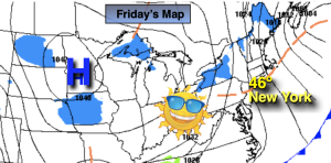
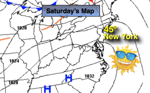
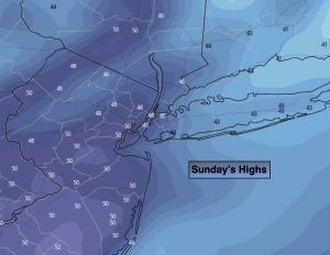
Today will be the milder half of the weekend with the sun making an appearance. Temperatures will rise several degrees above the average high of the lower 40s as an area of low pressure moves from Southeastern Canada to off the Northern New England coast.
High pressure will replace the departing low in the Northeast tonight. All readings will be at or below freezing under a clear sy.
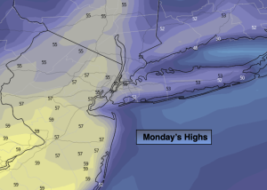
Sun will give way to clouds Monday with seasonable readings as the high retreats into Northern New England. Light snow will break out during the evening from West to East.
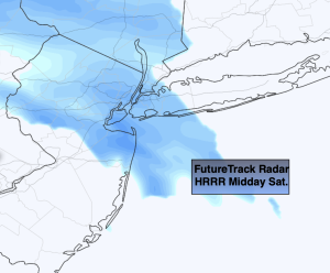
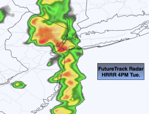
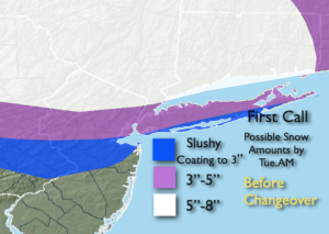
A storm will develop over the Ohio Valley and redevelop along the Mid-Atlantic coast Monday night and move offshore Tuesday. Enough cold air now looks to be in place that the potential for an accumulating snow has increased for the Northern 1/2 of the region.
First potential snow map of the seaon and it took until the end of February to create it! I’ve been doing this for a couple of decades (and then some)- this is the latest ever. It all starts Monday evening from West to East and tapers off Tuesday morning. The amounts are before any changeover in the Southern bands. The bust zone is the Southern most swath. Remember this is not etched in stone but the current thinking at this time. The amounts will most likely alter some. Farther to the South, any frozen precipitation will go over to rain. A light mix or light rain will continue into the first half of Tuesday. Clouds will hang tough,
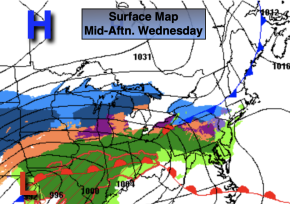
The sun will return for a brief break on Wednesday as high pressure says a quick hello.
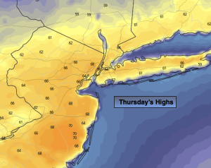
A weak low will move through the region on Thursday morning with scattered showers. The sun will return with readings well above average.
Stay tuned.
Keep it here for a no hype, no nonsense forecast.
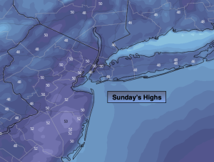
Sunday:
Partly sunny, breezy and milder. High in the upper 40s. Southwest to West winds at 5-15mph with gusts to 25mph later in the day.
Tonight:
Clear, breezy and cold. Lows around freezing in City, the teens and 20s inland. Northwest winds at 8-15mph.
Monday:
Sun to clouds. Light snow developing during the evening hours. High in the mid 40s.
Tuesday:
Light snow, mix, rain in the morning depending on location. Remaining mostly cloudy during the afternoon. Highs in the upper 30s to mid 40s.
Wednesday:
Sunny. Highs mid 40s.
Thursday:
Morning showers to sunshine. Milder. High in the lower 50s.