Synopsis:
A warm front will move into the region today. More clouds will result along with higher humidity. A few showers or storms are possible in the afternoon.
The heat will return Thursday and Friday with highs both days in the lower to mid 90s as a bubble of hot air remains over the region. The heat index will hover around 100º both days. A spot PM storm is possible Thursday and Friday.
The weekend will be very warm but dry under a mix of sun and clouds. The humidity should be a tad lower than late week.
Stay tuned.
Keep it here for a no nonsense, no hype forecast…
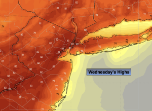
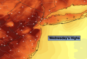
Wednesday:
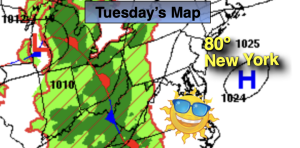
Mostly cloudy. Spotty PM Storm. Highs around 80º. South winds at 8-12mph.
Tonight:
Spotty evening shower or storm, otherwise partly cloudy and muggy. Lows in the lower 70s in the City, the 60s inland. Light Southwest wind.
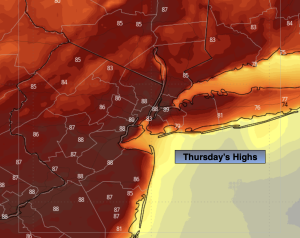
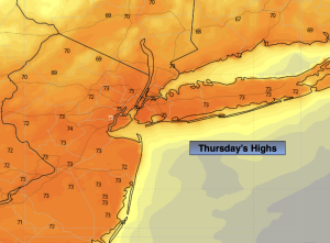
Thursday:
Hazy, hot and humid. Spotty PM storm. Highs in the lower to mid 90s. Heat index around 100º.
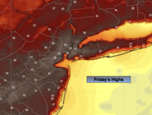
Friday:
Partly sunny, hot and humid. Spotty PM storm. Highs in the lower to mid 90s. Heat index around 100º.
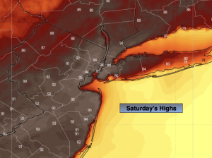
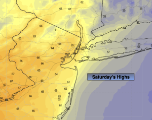
Saturday:
Mostly sunny. Highs in the upper 80s.
Sunday:
Partly sunny. Highs in the upper 80s.