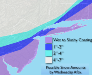
Synopsis:
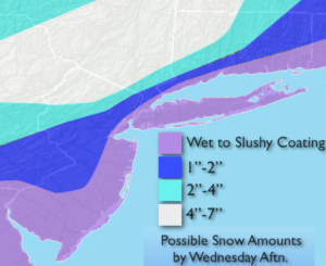
A low moving up and off the coast this morning will cause accumulating snow, just inland. A mix or even some rain exists along the coast, this will keep amounts much lower to virtually no accumulation (possible snow amounts above). This is a quick hitting system. The precipitation will taper off later this morning. The sun may make an appearance later in the day.
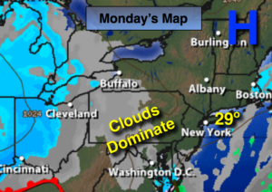
Seasonally cold conditions will be with us through the end of the week with the sun dominating.
High pressure will move off the Southeast coast during the weekend and bring up a mild airmass. Readings will be ten degrees above average.
Stay tuned.
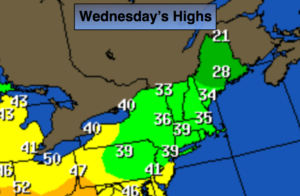
Wednesday:
Mostly cloudy accumulating snow ending by mid to late morning inland. Rain or a mix is possible along the coast. Highs in the 30s. Northwest winds at 10-15mph.
Tonight:
Clear and cold. Lows in the lower to mid 20s in the City, the teens inland. Northwest winds at 8-12mph.
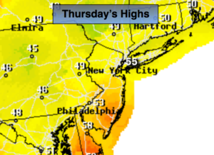
Thursday:
Partly sunny. Highs just above freezing.
Friday:
Partly sunny. Highs around 40º.
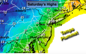
Saturday:
Partly sunny, milder. Highs in the mid to upper 40s.
Sunday:
Partly sunny. Mild. Highs in the upper 40s.
Keep it here for a no nonsense, no hype forecast.