Synopsis:
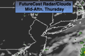
Isolated storms will be around into this evening. It’ll be humid. Skies will become clear overnight.
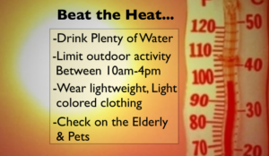
An area of high pressure will develop and sit off the East coast for several days. This will be responsible for a heatwave that will begin on Friday and most likely continue into midweek. The peak of the heat looks to arrive as we turn the calendar to July on Sunday. Record highs will be approached and 100º is not out of the question in the typical hot spots. The combination of the high temperatures and high humidity will result in a heat index of 100º-105º this weekend into the beginning of next week. Please take this situation seriously and listen to your body for signs of heat exhaustion. Drink plenty of fluids and try to limit your time outdoors between 10am-4pm.
Stay tuned.
Tonight:
A spotty early storm otherwise, mostly clear. Lows in the lower 70s in the City, the 60s elsewhere. Northwest winds at 5mph.
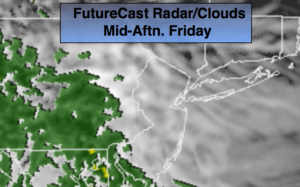
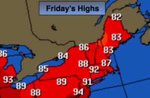
Friday:
Sunny and hot. Highs in the lower 90s.
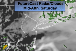
Saturday:
Hazy, hot and humid. Highs in the mid 90s. Heat index 100º.
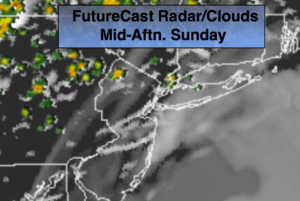
Sunday:
Hazy, hot and humid. Highs in the upper 90s. Heat index near 105º.
Monday:
Hazy, hot and humid. Highs in the mid 90s. Heat index 100º-105º.
Tuesday:
Hazy, hot and humid. Highs in the lower 90s. Heat index 95º-100º.
Keep it here for a no nonsense, no hype forecast.