Synopsis:
Scattered showers and storms will occur mainly this morning with a disturbance moving through. The sun will make an appearance for many later. Isolated storms can’t be ruled out this afternoon and evening. It’ll be humid. The warm front (the cause for the inclement weather) will bring a heatwave our way starting Friday.
The hottest weather of the year so far, will be with us this weekend as we turn the page to July. The combination of the high temperatures and high humidity will result in a heat index of 100º-105º this weekend into the beginning of next week. Please take this situation seriously and listen to your body for signs of heat exhaustion. Drink plenty of fluids and try to limit your time outdoors between 11am-5pm.
Stay tuned.
Today:
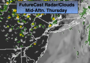
A period of morning rain and thunderstorms. The sun should make an appearance. Isolated afternoon and evening storms are possible. Humid. Highs in the lower 80s. South winds at 5-10mph.
Tonight:
A spotty early storm otherwise, partly cloudy. Lows in the lower 70s in the City, the 60s elsewhere. Northwest winds at 5mph.
Friday:
Sunny and hot. Highs around 90º.
Saturday:
Hazy, hot and humid. Highs in the mid 90s. Heat index 100º.
Sunday:
Hazy, hot and humid. Highs in the upper 90s. Heat index near 105º
Monday:
Hazy, hot and humid. Highs in the mid 90s. Heat index 100º-105º
Keep it here for a no nonsense, no hype forecast.