Synopsis:
Ahead of the approaching cold front, balmy readings are expected with periods of rain today. Well North and East of the City the cold air will hang tough. The cold front will move through tonight. Sunday will be partly sunny and cooler.
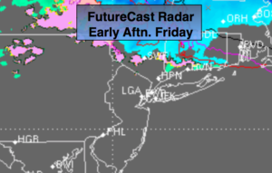
Now on to Christmas Eve Night and early Christmas morning. A low will form off the Mid-Atlantic coast. It looks as though (with the latest computer guidance) that the developing storm will form to0 far North and East to be a big player. A bit of light snow or snow showers is possible, especially from the City North and West. If an inch falls by Christmas morning it will be considered a “White Christmas”. The potential is there for a light snowfall of maybe 1″-3″over Northwestern NJ and into lower NY State through interior CT. At the coast and to the South the chances are quite low and some areas may not have a whitening of the ground Christmas morning.
Much colder times are on the way for next week. There has been chatter about a storm late in the week or next weekend. A storm mostly likely will be on the map. Where it sets up and goes from there is anybody’s guess.
Stay tuned..
Today:
Cloudy with periods of rain. Turning warmer from the City and to the South. Highs in the 50s. The 40s and 30s North and East. East to Southwest winds at 5-10mph.
Tonight:
Evening rain ending, otherwise, becoming mostly clear. Lows in the mid to upper 30s in the City, the 20s inland. Northwest winds at 10-15mph.
Christmas Eve:
Mostly sunny. Cooler. Highs in the mid 40s.
Christmas Day:
Early morning snow showers, otherwise mostly sunny and colder. Highs in the mid 30s.
Tuesday:
Mostly sunny. Cold. Highs around 30º.
Wednesday:
Mostly sunny. Cold. Highs around 30º.
Keep it here for a no nonsense, no hype forecast.