Synopsis:
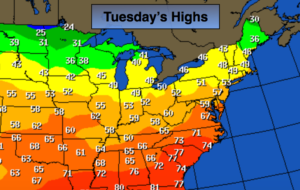
The last few days of Fall will be mild. A southwest flow will continue ahead of the next cold front that will move through the region tonight. Clouds will win the battle but a few peeks of sun are expected. Readings today will be in the 50s! The map above depicts just how mild the country is.
A cool down will occur Tomorrow and Thursday. Winter arrives Thursday at 11:28AM. The change of season will be fairly uneventful.
Looking down the pike. Temperatures will be above average Friday into the weekend. After this time frame it does get interesting. The jet stream will be active and there is a decent amount of cold air just to our North during the days in and around and following Christmas. Will the warm air win out or will the cold air dominate? Areas of low pressure will ride along the deep trough in the jet stream. How will it all play out?
Stay tuned.
Today:
More clouds than sun, mild. Highs in the lower 50s. West winds at 10-15mph.
Tonight:
Partly cloudy. Lows in the 30s throughout. West winds at 10-15mph.
Wednesday:
Partly sunny, breezy and cooler. Highs in the lower to mid 40s.
Thursday:
Mostly sunny and chilly. Highs in the upper 30s.
Friday:
Mostly sunny and mild. Highs around 50º.
Saturday:
Cloudy with rain. Balmy. Highs well into the 50s.
Keep it here for a no nonsense, no hype forecast.