Synopsis:
A weak disturbance moving in from the West will cause scattered showers later this evening. A weak low on a stationary front to our South may enhance the rainfall later tonight. Some of the computer models are suggesting a band of heavy rain will setup over parts of the tri-state area.
Summer arrives on Thursday at 6:07AM. At that time, any showers will be ending. The change of season promises not to disappoint as high pressure works in and the sun will return for the beginning of Summer. The high will provide seasonal temperatures and pleasant conditions Friday, despite plenty of clouds.
A moist flow from the Southeast with an approaching warm front will result in clouds thickening on Saturday. Showers are possible just about any time. Hopefully, we’ll squeak out some dry time. Sunday will be the better half of the weekend with more sun and warmer readings.
Stay tuned.
Tonight:
Cloudy with scattered late evening showers. A period of steadier and heavier rain is possible overnight for most of the region. Lows in the lower to mid 60s. Winds becoming Northeast 5-10mph.
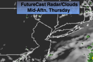
Thursday:
Early morning rain East otherwise, mostly sunny. Highs in the lower 80s. Northeast winds at 5-10mph.
Friday:
Clouds and sun. Highs in the mid to upper 70s.
Saturday:
Mostly cloudy with scattered showers and possible thunderstorms. Highs in the mid to upper 70s.
Sunday:
Sun and clouds. Warmer. Highs in the mid 80s.
Monday:
Partly sunny and pleasant. Highs in the lower 80s.
Keep it here for a no nonsense, no hype forecast.