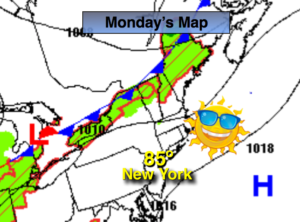
Synopsis:
High pressure will slip offshore today. This will turn the winds to the Southwest and result in warmer readings under mainly sunny skies.
Tonight will be partly cloudy and not as cool as recent nights.
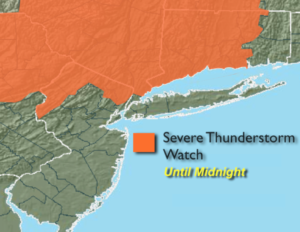
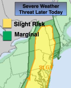
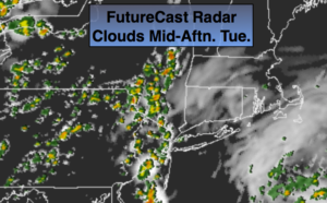
On Tuesday, a cool front will approach. Scattered showers and storms are expected during the afternoon. It will be humid. Some of the storms maybe strong to severe. Flash flooding may also be of concern.
The system will move slowly off the coast on Wednesday. A few showers are possible, especially in the morning, otherwise a mix of clouds and sun is expected.
The end of the week is looking dry with near seasonal temperatures.
Keep it here for a no nonsense, no hype forecast.
Today:
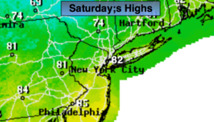
Mostly sunny, warmer. Highs in the mid 80s. Winds becoming Southwest at 8-15mph.
Tonight:
Partly cloudy. Lows in the lower 70s in urban areas, the 60s inland. Southwest winds at 5-10mph.
Tuesday:
Hazy, warm and humid. Scattered afternoon showers and storms. Highs in the mid 80s.
Wednesday:
Clouds and sun. Scattered showers. Highs in the lower 80s.
Thursday:
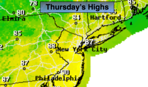
Partly sunny. Highs in the lower 80s.
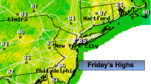
Friday:
Mostly sunny. Highs in the lower 80s.