Synopsis:
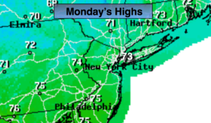
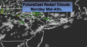
More clouds than sun is expected for today. It’ll be seasonal. A cool front will approach the region by late this afternoon with a few showers, much of the day will be dry.
Strengthening high pressure will dominate the Eastern one third of the nation through the rest of the week. The result will be plenty of sunshine and cooler than average readings Tuesday through Thursday. The average high temperature is 75º. There will be in a nip in the air during the overnights. Hurricane Humberto will remain well off the US coast and continue into the far Atlantic.
Enjoy this great September weather!
Stay Tuned.
Keep it here for a no nonsense, no hype forecast.
Today:
Sun and clouds. Spotty late day and evening showers. Highs in the mid to upper 70s. Northeast winds at 5-10mph.
Tonight:
An isolated evening shower, otherwise becoming mostly clear and chilly. Lows in the 50s to around 60º in urban areas, the upper 40s and lower 50s inland. Northeast winds at 5-10mph.
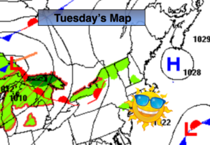
Tuesday:
Sunny. Cooler. Highs in the mid 70s.
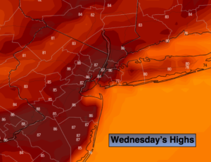
Wednesday:
Sunny. Highs in the lower to mid 70s.
Thursday:
Sunny. Highs in the mid 70s.
Friday:
Sunny. Highs in the upper 70s.