Synopsis:
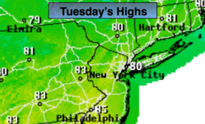
High pressure will move into the Northeast today. Skies will be mainly sunny with seasonal temperatures for early September (average highs are around 80º).
Wednesday will be warmer and more humid with a Southwesterly flow. A cool front will pass late Wednesday with a few showers, much of the day will be dry.
It’ll feel more like fall late week with a Northerly wind.
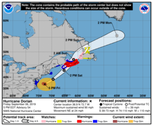
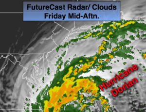
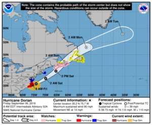
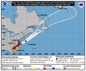
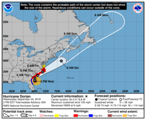
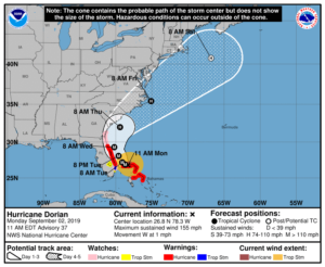
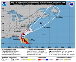
Hurricane Dorian should track up and off our coast on Friday. There is a chance of some rain as the hurricane makes it’s closest approach but we shouldn’t experience rough conditions. The best chance of rain will be along the coast. Please check back to JMW for the very latest for our area.
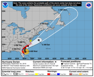
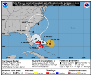
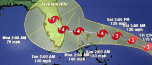
Category 2 Hurricane Dorian is just North of Grand Bahama Island with 110mph sustained winds as of this writing. The storm continues it’s slow weakening trend, but still is a major hurricane. The hurricane is beginning to move again (after a 30 hour stall) to the Northwest at 2mph.
The computer models parallel the hurricane off the Florida coast just far enough to spare severe damage. Residents should never let their guard down until the hurricane is North of their latitude as any deviation in the track to the West will result in the situation becoming dire rapidly.
The potential storm track continues a Northeast motion up and just off the Georgia and Carolina coastline Wednesday and Thursday. Once again a little shift to the West could mean perilous situation. The hurricane then gets off our coastline on Friday. A period of rain is possible if the bands are close enough. The best chance is for coastal areas and Long Island. Dorian looks to stay far enough offshore to spare our area of its menacing affects.
Stay Tuned.
Keep it here for a no nonsense, no hype forecast.
Today:
Mostly sunny, warm and less humid. Highs around 80º. Northeast to Southeast winds at 5-10mph.
Tonight:
Clear. Lows near 70º in the City, the lower 60s inland. South winds at 5mph.
Wednesday:
Partly sunny, warm and more humid. Late showers are possible. Highs in the mid to upper 80s.
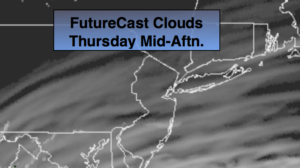
Thursday:
Partly sunny, much cooler and less humid. Highs only in the lower 70s.
Friday:
Clouds some sun. A period of rain is possible, especially at the coast and to the East. Highs only around 70º.
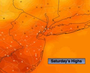
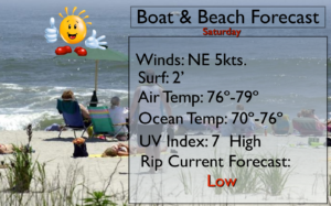
Saturday:
Partly sunny. Highs in the upper 70s.