Synopsis:
Spotty storms are possible this evening as a cool front approaches. It will remain humid overnight. Thursday will be mostly cloudy with on and off showers meaning there will be dry times as the front slows as it passes to our South. It will be much cooler.
Friday will be Fall-like with high pressure over New England giving us a cooler close to the week under mostly sunny skies.
The weekend will be fairly decent. A spot shower is possible on Saturday otherwise a mix of sun and clouds is expected with comfortable temperatures. Sunday will be bright and warm.
Stay Tuned.
Keep it here for a no nonsense, no hype forecast.
Tonight:
Isolated early storms otherwise, partly cloudy and muggy. Lows around 70º in the City, the mid 60s inland. South to North wind at 5mph.
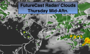
Thursday:
Mostly cloudy. On and off showers and isolated storms. Highs near 80º. Northeast winds at 8-12mph.
Friday:
Mostly sunny, much cooler. Highs in the lower 70s.
Saturday:
Partly sunny. A spotty shower is possible. Highs in the mid to upper 70s.
Sunday:
Partly sunny, warmer. Highs in the lower 80s.
Monday:
Partly sunny. Warm. Highs in the lower 80s.