Synopsis:
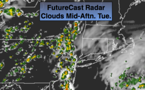
The humidity will be high through Wednesday as high pressure slips off the coast and a Southerly flow develops. Spotty afternoon storms are possible today. The best chance of storms will be Wednesday afternoon as upper level energy swings through.
A cool front will sweep through later Thursday. This front looks to come through dry as moisture is limited.
Friday will be sunny and comfortable as humidity levels will be low.
At this time, the weekend looks fantastic with plenty of sun and low humidity!
Keep it here for a no nonsense, no hype forecast.
Today:
Partly sunny. More humid. Spotty PM storms. Highs in the mid 80s. Southeast winds at 5-10mph.
Tonight:
Spotty evening storms, otherwise partly cloudy and muggy. Lows in the lower to mid 70s in urban areas, the 60s inland. South winds under 5mph.
Wednesday:
Hazy, warm and humid. Scattered afternoon showers and storms. Highs in the mid to upper 80s.
Thursday:
Partly sunny, not as humid. Highs in the mid to upper 80s.
Friday:
Partly sunny. Much lower humidity. Highs in the mid 80s.
Saturday:
Sunny and comfortable. A top ten day. Highs in the mid 80s.