Synopsis:
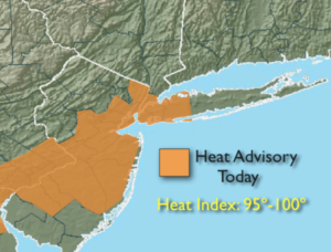
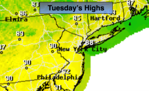
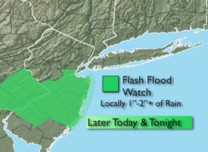
One more hot day is expected today before a major change in air masses occurs. Highs will be around 90º. Please take it slow outdoors and drink plenty of fluids. Scattered showers and storms are possible later in the day but are more likely later in the evening and overnight as a cool front approaches.
Relief will arrive by Friday. The day will start off with clouds and possibly a few showers along the coast but the sun will return. The weekend looks spectacular as Canadian high pressure moves in. Highs may only stay in the upper 70s!
Stay cool!
Keep it here for a no nonsense, no hype forecast.
Today:
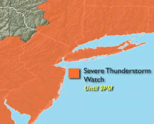
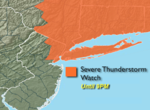
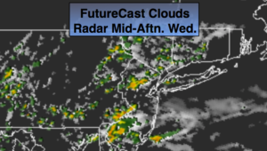
Hazy, hot and humid. Scattered evening storms. Highs around 90º. Southwest to West winds at 5-10mph.
Tonight:
Scattered showers and storms. Lows around 70º in the City, the 60s elsewhere. Northwest winds at 5-10mph.
Friday:
Clouds and a few coastal morning showers, otherwise becoming partly sunny. Much cooler and less humid. Highs in the upper 70s.
Saturday:
Sunny with low humidity. Highs around 80º.
Sunday:
Sunny with low humidity. Highs in the mid to upper 70s.
Monday:
Sunny with low humidity. Highs around 80º