Synopsis:
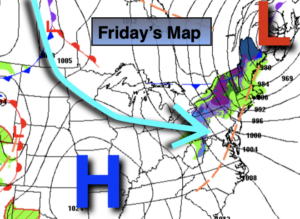
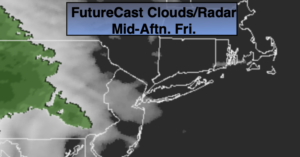
Morning sun will give way to clouds today. Showers will move in during the afternoon from West to East with weak low pressure approaching. Readings will be ten degrees below the average high of the lower 60s.
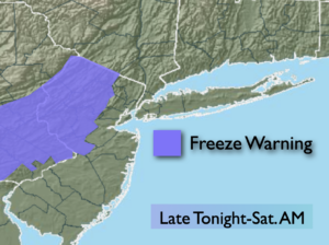
A period of rain is likely tonight as the low moves through the region. Well to the North and over the higher elevations wet snow is likely for a time. The potential is there for one to three inches of the white stuff. We are talking from the Catskills to near Poughkeepsie and into Northern and Central Connecticut. All other areas will remain wet and not white.
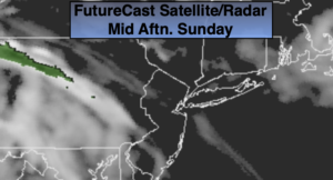
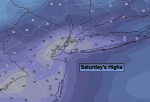
Saturday will start off damp with showers but the sun will return during the afternoon. Sunday will be mostly sunny as high pressure settles over the area. Sunday will definitely be the better and milder half of the weekend.
On Monday, a Developing storm will move up and off the coast. The rain shield from the system will graze the coast.
Tuesday will be partly sunny ahead of the next cold front.
Stay Tuned.
Keep it here for a no nonsense, no hype forecast.
Today:
Sun to clouds. Showers will move in during the afternoon from West to East. Highs around 50º. West to Southwest winds at 8-12mph.
Tonight:
Rain. Wet snow is possible well North over the Mid-Hudson Valley. Lows in the lower 40s in the City, the 30s inland. Winds becoming North at 5mph.
Saturday:
Morning showers, otherwise becoming partly sunny. Highs in the lower 50s.
Sunday:
Mostly sunny, more seasonal. Highs in the lower 60s.
Monday:
Clouds, some sun. A period of light rain is possible, mainly at the coast. Highs in the mid to upper 50s.
Tuesday:
Partly sunny. Highs in the lower 60s.
***Please take “social distancing” seriously during this time. We will get through this.****