Back to Work Tuesday. Bright, Warm but Less Humid…

Synopsis:

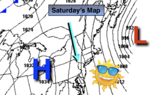
High pressure will move into the Northeast today.  Skies will be mainly sunny with seasonal temperatures for early September (average highs are around 80º).

Wednesday will be warmer and more humid with a Southwesterly flow. A cool front will pass late Wednesday with a few showers, much of the day will be dry.

It’ll feel more like fall late week with a Northerly wind.

Hurricane Dorian should track up and off our coast on Friday. There is a chance of some rain as the hurricane makes it’s closest approach but we shouldn’t experience rough conditions. The best chance of rain will be along the coast. Please check back to JMW for the very latest for our area.

Category 2 Hurricane Dorian is just North of Grand Bahama Island with 110mph sustained winds as of this writing. The storm continues it’s slow weakening trend, but still is a major hurricane. The hurricane is beginning to move again (after a 30 hour stall) to the Northwest at 2mph.

The computer models parallel the hurricane off the Florida coast just far enough to spare severe damage. Residents should never let their guard down until the hurricane is North of their latitude as any deviation in the track to the West will result in the situation becoming dire rapidly.

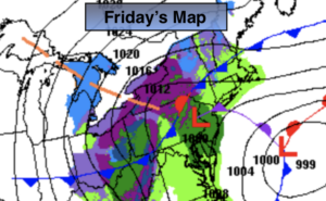
The potential storm track continues a Northeast motion up and just off the Georgia and Carolina coastline Wednesday and Thursday. Once again a little shift to the West could mean perilous situation. The hurricane then gets off our coastline on Friday. A period of rain is possible if the bands are close enough. The best chance is for coastal areas and Long Island. Dorian looks to stay far enough offshore to spare our area of its menacing affects.

Stay Tuned.

Keep it here for a no nonsense, no hype forecast.

Today:

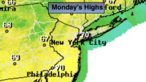
Mostly sunny, warm and less humid. Highs around 80º. Northeast to Southeast winds at 5-10mph.

Tonight:

Clear. Lows near 70º in the City, the lower 60s inland. South winds at 5mph.

Wednesday:

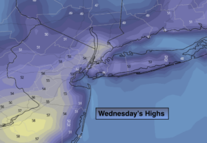
Partly sunny, warm and more humid. Late showers are possible. Highs in the mid to upper 80s.

Thursday:

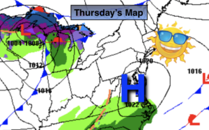
Partly sunny, much cooler and less humid. Highs only in the lower 70s.

Friday:

Clouds some sun. A period of rain is possible, especially at the coast and to the East. Highs only around 70º.

Saturday:

Partly sunny. Highs in the upper 70s.

Labor Day-Clouds Dominate. Sct’d Showers. Humid…

Synopsis:

A disturbance will approach from the West for Labor Day. More clouds than sun is excepted. Scattered showers are in the forecast. Local downpours are possible with a few thunderstorms.There will be dry times. One batch of rain will work in mid to late morning. Then there should be a break. More scattered showers and storms are possible later this afternoon and evening.

Warmer readings are anticipated as we head back to work and school midweek. The sun will dominate and readings will still feel Summery.

A cool front will pass late Wednesday with a few showers. It’ll feel more like fall late week with a Northerly wind. Hurricane Dorian should track up and off our coast on Friday. A few coastal showers are possible as the hurricane makes it’s closest approach but we shouldn’t experience rough conditions. Please check back to JMW for the very latest for our area.

Category 4 Hurricane Dorian has stalled over Grand Bahama Island with 155mph sustained winds as of this writing. Catastrophic damage continues.  Dorian is tied with the 1935 Labor Day Hurricane as the STRONGEST Atlantic hurricane to make landfall in modern history.

Upper level winds have weakened and the hurricane will sit for a least day between Grand Bahama and the Florida coast (2nd map above). Where Dorian makes landfall after the Bahamas is not known at this time. The million dollar question where does it go after that? Does it turn North before, along or after reaching the FL coast? If it turns North before reaching the coast much of FL will be spared it’s catastrophic effects. If it turns North just a bit later it will not be a good scenario. At this time the trend is for the storm to remain just offshore of Florida. Do not concentrate on the exact track but look at the cone of possibility. Hope for the best, prepare for the worst. The entire Southeastern coast has the potential to feel the affects of Dorian later this upcoming week.

Stay Tuned.

Keep it here for a no nonsense, no hype forecast.

Labor Day:

More clouds than sun. Scattered showers with local downpours and a few thunderstorms. There will be dry times. Highs in the upper 70s. South winds at 5-10mph.

Tonight:

Scattered showers and storms this evening, otherwise becoming partly cloudy. Lows in the mid 60s in the City, the upper 50s inland. West to North winds at 5mph.

Tuesday:

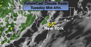
Partly sunny and warm. Highs in the lower to mid 80s.

Wednesday:

Partly sunny, warm and more humid. Late showers are possible. Highs in the mid to upper 80s.

Thursday:

Partly sunny, much cooler and less humid. Highs only in the lower 70s.

Friday:

Clouds and sun. Coastal showers possible. Highs only in the lower 70s.

Fine Start to the Labor Day Weekend…

Synopsis:

At this time it looks like we’ll take 2 out of 3 days for the Labor Day Holiday Weekend. High pressure will build in from the North today and tomorrow. Sun and clouds are expected with near seasonal temperatures (around 80º). On Labor Day Monday a cool front will approach. There is a chance of scattered showers. It doesn’t look like a washout.

Warmer readings are anticipated as we head back to work and school midweek.

Hurricane Dorian is now moving West in the Atlantic East of the Bahamas. Dorian is a major hurricane- category 4 status with sustained winds, as of this writing of 150mph. The hurricane will slow down as a strong ridge of high pressure over the Western Atlantic and steers the hurricane West. Upper level winds will become weak. Dorian may stall for a time over the Northern Bahamas (2nd map above). Where Dorian makes landfall is not known at this time. The million dollar question where does it go after that? Does it turn North before, along or after reaching the FL coast? If it turns North before reaching the coast much of FL will be spared it’s catastrophic effects. If it turns North just a bit later it will not be a good scenario. At this time the trend is for the storm to remain just offshore of Florida. Do not concentrate on the exact track but look at the cone of possibility. Hope for the best, prepare for the worst. The entire Southeastern coast has the potential to feel the affects of Dorian later this upcoming week.

Stay Tuned.

Keep it here for a no nonsense, no hype forecast.

Saturday:

Sun and clouds. Highs lower 80s. Northeast winds at 5-10mph.

Tonight:

Partly cloudy. Lows in the mid to upper 60s in the City, the 50s inland. Northeast winds at 5mph.

Sunday:

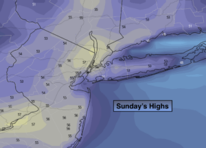
Sun & clouds. Highs in the upper 70s.

Labor Day:

More clouds than sun. Scattered showers possible. Highs around 80º.

Tuesday:

Partly sunny and warm. Highs in the lower to mid 80s.

Wednesday:

Partly sunny, warm and more humid. Late showers are possible. Highs in the mid 80s.

Getaway Friday-Bright, Warm & Low Humidity…

Synopsis:

High pressure will over the Southeast will result in a bright, warm and comfortable getaway day Friday. Readings will be several degrees above the average high of 80º.

A weak cool front will move through tonight. It will come through uneventful.

At this time it looks like we’ll take 2 out of 3 days for the Labor Day Holiday Weekend. High pressure will build in from the North Saturday and Sunday. The sun will dominate with near seasonal temperatures. A few more clouds are expected on Sunday. On Labor Day Monday a cool front will approach. There is a chance of scattered showers. It doesn’t look like a washout.

Hurricane Dorian continues to move Northwest in the Atlantic. Dorian is forecast to become a major hurricane- category 4 status with sustained winds of 140mph by this late this weekend and into Labor Day .  The computer models have slowed the hurricane considerably by the weekend into Monday as a strong ridge of high pressure over the Western Atlantic and steers the Hurricane West (2nd map above). Where the Dorian makes landfall is not known at this time. The concern is with the slow movement (basically a crawl) some areas of Florida will have a prolonged time of very dangerous conditions. Is it possible that the storm stays just off the coast before the North turn? Yes. But this solution right now is the outlier. Please do not concentrate on the exact track, but rather on the yellow cone of uncertainty.

Stay Tuned.

Keep it here for a no nonsense, no hype forecast.

Today:

Sunny, warm. Highs in the mid 80s. Southwest winds at 8-12mph.

Tonight:

Clear and comfortable. Lows in the mid 60s in the City, the 50s inland. Northwest to North winds at 5-10mph.

Saturday:

Mostly sunny. Highs lower 80s.

Sunday:

Sun & clouds. Highs in the upper 70s.

Labor Day:

More clouds than sun. Scattered showers possible. Highs around 80º.

Tuesday:

Partly sunny and warm. Highs in the lower to mid 80s.

Spectacular Thursday. Bright, Warm-Low Humidity…

Synopsis:

High pressure will build in from the Tennessee Valley today and Friday. Bright, warm but less humid days are expected. A cool front will move through Friday night.

At this time it looks like we’ll take 2 out of 3 days for the Labor Day Holiday Weekend. High pressure will build in from the North Saturday and Sunday. The sun will dominate with near seasonal temperatures. On Labor Day Monday a cool front will approach. There is a chance of scattered showers. It doesn’t look like a washout.

Hurricane Dorian continues to move Northwest in the Atlantic. Dorian is forecast to become a major hurricane- category 4 status with sustained winds of 130mph by this weekend.  The computer models take the storm into Florida late Sunday as a strong ridge of high pressure develops over the Western Atlantic and steers the Hurricane West (2nd map above). Please do not concentrate on the exact track, but rather on the yellow cone of uncertainty.

Stay Tuned.

Keep it here for a no nonsense, no hype forecast.

Today:

Sunny, warm and less humid. Highs in the lower to mid 80s. Northwest winds at 8-12mph.

Tonight:

Clear and comfortable. Lows in the mid 60s in the City, the 50s inland. West winds at 5mph.

Friday:

Mostly sunny, warm. Highs in the mid 80s.

Saturday:

Mostly sunny. Highs lower 80s.

Sunday:

Sun & clouds. Highs in the upper 70s.

Labor Day:

More clouds than sun. Scattered showers possible. Highs in the upper 70s.

Scattered Showers This Evening. Spectacular Thursday…

Synopsis:

Scattered showers will move through the region this evening as a weak front moves in from the West. Skies will clear after midnight and humidity levels will drop by morning.

High pressure will build in from the Tennessee Valley Thursday and Friday. Bright, warm but less humid days are expected. A cool front will move through Friday night.

At this time it looks like we’ll take 2 out of 3 days for the Labor Day Holiday Weekend. High pressure will build in from the North Saturday and Sunday. The sun will dominate with near seasonal temperatures. On Labor Day Monday a cool front will approach. There is a chance of scattered showers. It doesn’t look like a washout.

Hurricane Dorian continues to move away from the islands of the Northeast Caribbean. Dorian is expected to become a major hurricane- category 3 status with sustained winds of 115mph by this weekend.  The computer models take the storm into Florida late Sunday as a strong ridge of high pressure develops over the Western Atlantic and steers the Hurricane West (2nd map above). Please do not concentrate on the exact track, but rather on the yellow cone of uncertainty.

Stay Tuned.

Keep it here for a no nonsense, no hype forecast.

Tonight:

Scattered showers early. Clearing skies after midnight. Lows in the mid to upper 60s in the City, the upper 50s inland. Winds becoming Northwest at 5-10mph.

Thursday:

Mostly sunny, warm and less humid. Highs in the lower to mid 80s. Northwest winds at 8-12mph.

Friday:

Mostly sunny, warm. Highs in the mid 80s.

Saturday:

Mostly sunny. Highs lower 80s.

Sunday:

Sun & clouds. Highs in the upper 70s.

Labor Day:

More clouds than sun. Scattered showers possible. Highs in the upper 70s.

More Humid Today. Sct’d Showers/Storms…

Synopsis:

Clouds will dominate today. The humidity will be much higher than recent days with a  Southerly flow. The combination a front approaching from the West and some moisture getting in the mix from Tropical Depression Erin well off the coast will result in scattered showers and possible thunderstorms just about anytime, but much of the time will be dry. The best threat will be in the afternoon and evening.

High pressure will build in from the Tennessee Valley Thursday and Friday. Bright warm but less humid days are expected. A cool front will move through Friday night.

At this time it looks like we’ll take 2 out of 3 days for the Labor Day Holiday Weekend. High pressure will build in from the North Saturday and Sunday. The sun will dominate with near seasonal temperatures. On Labor Day Monday a cool front will approach. There is a chance of showers. The forecast isn’t etched in stone for Monday and may change for the better.

Stay Tuned.

Keep it here for a no nonsense, no hype forecast.

Today:

More clouds than sun. Warmer and more humid. Scattered showers and storms are possible just about anytime. The best chance will be during the afternoon and evening. Highs around 80º. East 5-10mph.

Tonight:

Mostly cloudy. Scattered showers or storms. Lows in the 60s throughout. Winds becoming Northwest at 5-10mph.

Thursday:

Mostly sunny, warm and less humid. Highs in the lower 80s.

Friday:

Mostly sunny, warm. Highs in the mid 80s.

Saturday:

Mostly sunny. Highs lower 80s.

Sunday:

Sun & clouds. Highs in the upper 70s.

Another Comfortable August Day…

Synopsis:

Today will feature a mix of sun and clouds with comfortable readings. Our stretch of below average readings will continue. Highs will remain in the 70s as high pressure moves off the New England coast.

Clouds will dominate tonight and Wednesday. The humidity will be on the rise with a Southerly flow as a cool front approaches. Scattered showers are likely during the afternoon and evening Wednesday.

High pressure will build in from the Tennessee Valley late week. This setup will result in warmer readings and plenty of sun as we approach getaway day Friday. The Labor Day Holiday Weekend at this time looks fairly decent!

Keep it here for a no nonsense, no hype forecast.

Today:

Clouds and sun. Highs in the mid 70s. East to Southeast winds at 5-10mph.

Tonight:

Mostly cloudy. Not as cool as recent nights. Lows in the 60s throughout. Southeast to East winds at 5mph.

Wednesday:

More clouds than sun. Warmer and more humid. A few late day or evening showers and storms are possible. Highs around 80º.

Thursday:

Mostly sunny, warm and less humid. Highs in the lower to mid 80s.

Friday:

Mostly sunny, warm. Highs in the mid 80s.

Saturday:

Mostly sunny, warm. Highs in the mid 80s.

Fall-Like Start to the Week. Warmer Late Week…

Synopsis:

High pressure over the Northeast, which originated in Canada will continue to give the area our Fall feel. Clouds and sun are expected today. Readings will be several degrees below the average high of 81º.

It’ll be another chilly night with readings in the lower 60s in the City, near 50º well inland.

Tuesday and Wednesday will be partly sunny. Temperatures will slowly rise to near seasonal averages by midweek. A weak cool front will move through Wednesday evening and night with a few showers.

High pressure this time will build from the Tennessee Valley late week. This setup will result in warmer readings and plenty of sun as we approach getaway day Friday.

Keep it here for a no nonsense, no hype forecast.

Today:

Clouds and sun. Cool. Highs in the mid 70s. Northeast to East winds at 5-10mph.

Tonight:

Mostly clear and cool. Lows in the lower in the City, the 50s inland. Southeast to East winds at 5mph.

Tuesday:

Partly sunny. Highs in the mid to upper 70s.

Wednesday:

Partly sunny and warmer. A few late day or evening showers are possible. Highs around 80º.

Thursday:

Partly sunny, warm. Highs in the lower to mid 80s.

Friday:

Mostly sunny, warm. Highs in the mid 80s.

Hint of Fall This Weekend- Refreshing Sun…

Synopsis:

The weekend looks spectacular as Canadian high pressure moves in. The sun will dominate. Readings will remain in the 70s with nighttime lows in the 50s and 60s- a hint of Fall!

The beginning of next week will start off tranquil with continued below average readings. The average high temperature is 82º. The next chance of showers won’t be until late Wednesday.

Keep it here for a no nonsense, no hype forecast.

Today:

Mostly sunny with low humidity. Highs in the mid to upper 70s. Northeast winds at 8-12mph.

Tonight:

Mostly clear and cool. Lows in the lower to mid 60s in the City, the 50s inland. Northeast wind at 5-10mph.

Sunday:

Mostly sunny. Highs in the mid to upper 70s.

Monday:

Partly sunny. Highs in the mid 70s.

Tuesday:

Partly sunny. Highs in the upper 70s.

Wednesday:

Clouds and sun. Scattered showers or storms possible. Highs around 80º.