Synopsis:
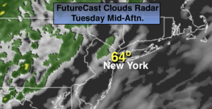
April-like readings will be with us today ahead of an approaching front. The sun may shine for a time this morning but clouds will win the battle. A few spotty showers are possible during the afternoon. Much of the day will be dry.
Early showers tonight, otherwise skies will clear as the front moves off the coast.
Above average temperatures will continue through the end of the week. Wednesday and Thursday will feature mainly sunny skies as weak high pressure settles over the Northeast.
By Friday a cool front will approach the area. Sun will give way to clouds and afternoon showers. It’ll be balmy.
Saturday will be bright with cooler temperatures but by no means will it be cold.
Spring officially arrives on March 19th.
Stay Tuned.
Keep it here for a no nonsense, no hype forecast.
Today:
Any sun giving way to mainly cloudy skies. Warm. Spotty afternoon showers. Highs in the mid 60s. Southwest winds at 10-15mph.
Tonight:
Scattered showers early, otherwise clearing skies. Lows in the mid 40s in the City, the 30s inland. Southwest to Northwest winds at 8-12mph.
Wednesday:
Partly sunny and mild. Highs in the mid 50s.
Thursday:
Partly sunny. Highs mid 50s.
Friday:
Mostly cloudy. Balmy. Showers likely. Highs in the mid 60s.
Saturday:
Partly sunny. Highs in the lower 50s.