Synopsis:
High pressure will build over the East today and Saturday. This will result in more seasonable temperatures under a bright sky. Saturday looks to be spectacular and the better half of the weekend.
On Sunday, Atlantic low pressure will most likely affect the region with clouds and showers by afternoon.
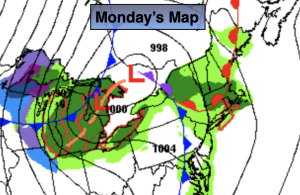
The threat of scattered showers remains on Monday as the low moves into New England. It doesn’t look to be too wet of a day.
Tuesday should be dry and mild as we get a break from the incoming disturbances.
Stay tuned.
Keep it here for a no hype, no nonsense forecast.
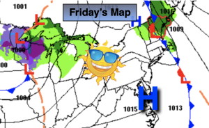
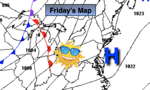
Friday:
Sunny. Highs in the lower 60s. West to South winds at 5-10mph.
Tonight:
Clear. Lows in the lower 50s in the City, 30s & 40s elsewhere. Southwest winds less than 5mph.
Saturday:
Sunny. Mild. Highs in the mid to upper 60s.
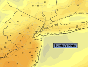
Sunday:
Showers likely by afternoon. Highs in the lower 60s.
Monday:
Scattered showers possible. Highs in the lower 60s.
Tuesday:
Partly sunny. Milder. Highs in the upper 60s.