Synopsis:
Low pressure will move off the coast today. On and off showers are expected. It’ll be dry for the majority of the time. It’ll be chilly with the flow off the colder Atlantic. Readings will be more than ten degrees below the average high of 62º.
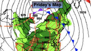
On Friday weakening low pressure over the ocean will keep the clouds dominant. Temperatures will still be below average.
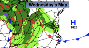
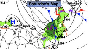
A cool front will sweep offshore Saturday morning fairly uneventful. Morning clouds will give way to sun. Typical temperatures are expected. Sunday will be bright and slightly cooler as high pressure moves in. Similar conditions are expected for Monday.
Stay tuned.
Keep it here for a no nonsense, no hype forecast.
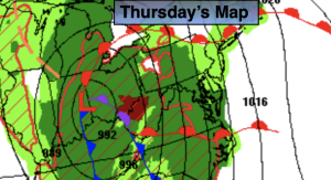
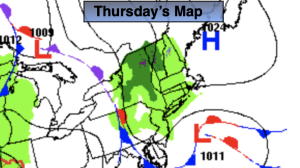
Thursday:
On and off showers. Chilly. Highs around 50º. Northeast winds at 10-20mph.
Tonight:
Spot shower early, otherwise cloudy. Lows in the lower 40s in the city the upper 30s inland. East to Northeast winds 8-15mph.
Friday:
Mostly cloudy. Cool. Highs in the mid 50s.
Saturday:
Clouds to sun. Highs in the mid 60s.
Sunday:
Mostly sunny. Highs around 60º.
Monday:
Sunny. Highs in the lower 60s.