Synopsis:
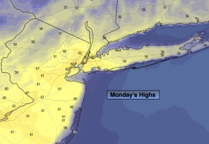
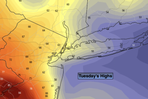
It was a Summer preview for many on Monday. Some readings away from the coast skyrocketed to near 90º. A complete turnaround will occur today as a backdoor cool front has moved through. Highs today will be almost twenty to thirty degrees cooler in spots than they were on Monday. Clouds will dominate today with moisture off the Atlantic. Scattered showers are possible tonight into early Wednesday morning with a disturbance moving through. More clouds than sun is expected on Wednesday but the majority of the day will be dry.
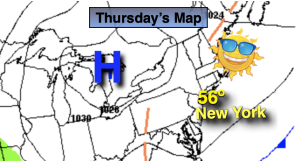
High pressure will begin to build off the Southeast coast on Thursday. This will result in drier air and more in the way of sunshine. Readings should get to just above average. The average high is around 70º.
It’ll be a nice close to the workweek with pleasant readings and bright skies.
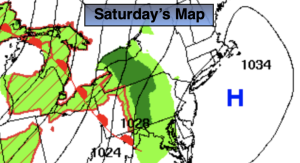
Saturday will feature increasing clouds and the possibility of afternoon showers as a disturbance moves in from the West. These showers may hold off until nighttime.
Stay tuned.
Keep it here for a no nonsense, no hype forecast.
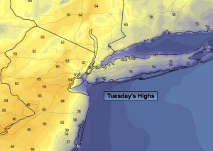
Tuesday:
Mostly cloudy. Much cooler. Highs in the lower 60s. East to Northeast winds at 5-10mph.
Tonight:
Scattered showers. Lows in the 50s throughout. Light Northeast winds.
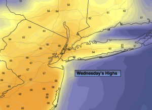
Wednesday:
Spotty morning shower, otherwise clouds giving way to some sun. Highs in the mid 60s.
Thursday:
Mostly sunny. Milder. Highs in the lower 70s.
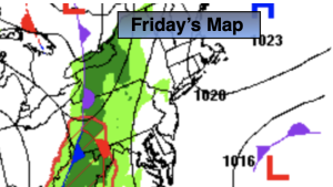
Friday:
Partly sunny. Seasonable. Highs around 70º.
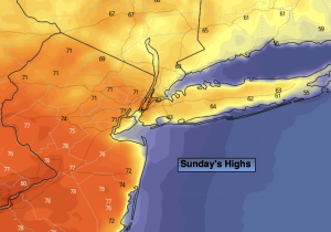
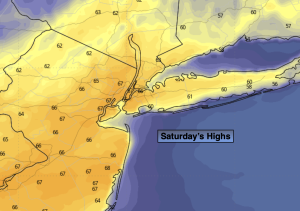
Saturday:
Sun to clouds. Chance of late day showers. Cooler. Highs in the lower to mid 60s.