Synopsis:
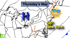
Cooler conditions are expected Thursday (compared to Wednesday’s mid 70s) as a Canadian airmass pays a visit. It’ll be a similar forecast for Friday and Saturday as offshore high pressure dominates.
Tonight will be cold with readings inland dropping to freezing or below. Freeze Warnings and Frost Advisories have been posted for areas to the North and West.
By Sunday, the return flow around the Western Atlantic high will cause temperatures to skyrocket into the 70s. Monday will feature a Summer preview with readings soaring into the lower 80s.
Stay tuned.
Keep it here for a no nonsense, no hype forecast.
Thursday:
Sunny. Cooler. Highs in the mid 50s. Northeast to Southeast winds at 5-10mph.
Tonight:
Clear and chilly. Lows in the lower 40s in the City, the upper 20s and 30s inland. Light Southeast to East winds.
Friday:
Sunny. Highs around 60º.
Saturday:
Sun to clouds. Highs in the lower 60s.
Sunday:
Clouds to sun. Warmer. Highs in the mid 70s.
Monday:
Mostly sunny. Warm. Highs in the lower 80s.