Synopsis:
The storm that has been affecting our region will slowly pull away today. Spotty showers and areas of drizzle will be with us. There will be dry times.
The atmosphere will take some time to dry out as the storm moves out to sea. Mainly cloudy skies are expected tonight with patchy drizzle and fog.
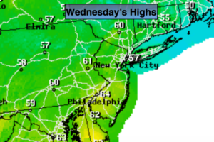
Thursday will start off cloudy but the sun should make an appearance. Along the immediate coast the grey skies may persist.
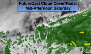
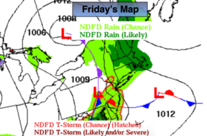
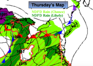
A warm front will swing through Thursday night and Friday morning with scattered showers. A warm push will arrive Friday and Saturday. Temperatures will reach June-like levels. Cooler air will return for Sunday. At this time the weekend looks fairly decent with only a spotty storm expected later Saturday afternoon.
Stay tuned.
Today:
Spotty showers, areas of drizzle. Remaining mostly cloudy. Highs in the lower 60s. North/Northeast wind at 5-10mph.
Tonight:
Cloudy with patchy drizzle and areas of fog. Lows in the 50s throughout. Light Northeast wind.
Thursday:
Clouds will give way to some sun, especially inland. Milder. Highs around 70º.
Friday:
Partly sunny. Warm. Highs around 80º.
Saturday:
Summer-like. Partly sunny. Chance of a spotty afternoon or evening thunderstorm. Highs 80º-85º.
Sunday:
Partly sunny. Not as warm. Highs in the upper 60s.
Keep it here for a no nonsense, no hype forecast.