Synopsis:
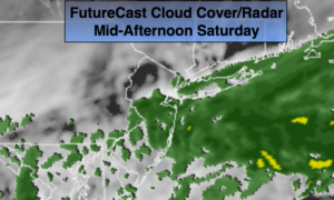
A weak front over the region today will result in on and off showers. FutureCast radar and cloud cover above. It will not be a washout, but it will be raw. Temperatures will be below average.
On Sunday the sun will dominate as a ridge of high pressure works in. Readings will be seasonal. The average high for the date is 63º.
Another storm will move up and off the coast for the early week period with a chance of rain.
Stay tuned.
Today:
Mostly cloudy and cool with scattered showers. There will be dry times. Highs in the upper 50s. Northwest winds at 5-10mph.
Tonight:
Becoming mostly clear late. Lows in the upper 40s in the City, the upper 30s inland. Winds becoming North at 8-12mph.
Sunday:
Mostly sunny. Highs in the lower to mid 60s.
Monday:
Sun to clouds. Chance of afternoon showers. Highs in the mid 60s.
Tuesday:
Mostly cloudy with a chance of rain. Highs in the upper 50s.
Wednesday:
Clouds to sun. Highs around 70º.
Keep it here for a no nonsense, no hype forecast.