Synopsis:
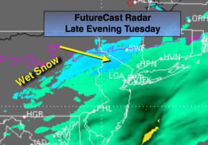
The first snow of the season will fall over the highest elevations North and West this evening and early tonight. There will be just enough cold air for the white stuff. A slush coating is possible in spots again over the highest elevations of Northwest NJ, the Poconos, Southern Catskills and Orange County, NY. Elsewhere, a chilly rain will fall. This weak area of low pressure will move off the coast just to our South early Wednesday morning.
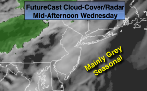
High pressure will move for Wednesday and Thursday with fair conditions and below average temperatures.
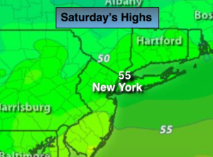
It’ll turn much colder Friday into Saturday as a significant cold front moves by. A hard freeze is expected throughout the tri-state area Friday night-readings will be in the 20s. The weekend will feature plenty of sunshine with readings recovering into the lower 50s by Sunday.
Stay tuned.
Tonight:
Wet snow likely over the highest elevations North and West with rain elsewhere ending after midnight. Cold. Lows in the 30s throughout. North to Northeast wind at 8-12mph.
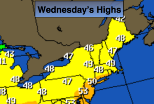
Wednesday:
Partly sunny and chilly. Highs around 50º.
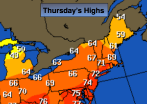
Thursday:
Partly sunny, cool. Highs in the lower 50s.
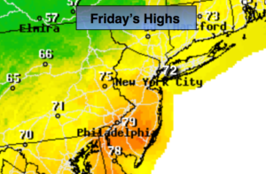
Friday:
Partly sunny, windy and much colder. Highs only around 40º. Temperatures falling into the 30s by mid-afternoon.
Saturday:
Sunny, breezy and cold. Highs in the lower 40s.
Sunday:
Partly sunny and cool. Highs in the lower 50s.
Keep it here for a no nonsense, no hype forecast.