Synopsis:
A high pressure system over Eastern Canada will continue to supply cooler and more seasonal readings for mid-October through Friday. A mix of sun and clouds is expected.
The seasonal readings won’t last too long as the upcoming weekend looks to be much warmer as a Southwesterly flow takes hold once again. A weak disturbance will provide plenty of clouds on Saturday with a few spotty showers. It will not be a washout. Sunday morning may start off with a spot shower otherwise skies will be partly sunny. It’ll be warm with highs around fifteen degrees above average. The average high is 65º.
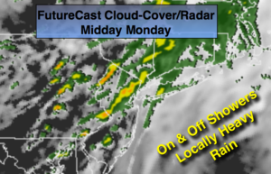
A cold front will move in Sunday Night with a shower. The beginning of the workweek looks pleasant with typical readings for this time of the year.
Stay tuned.
Tonight:
Clear to partly cloudy. Lows in the lower to mid 50s in the City, the 40s inland. East wind at 5-10mph.
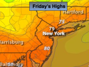
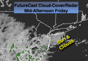
Friday:
Partly sunny. Highs in the mid 60s. East winds at 8-12mph.
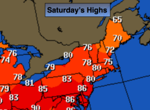
Saturday:
Mostly cloudy and mild with spotty showers. Highs in the lower to mid 70s.
Sunday:
Clouds and sun. A spot morning shower. Warm. Highs near 80º.
Monday:
Partly sunny and much cooler. Highs in the mid 60s.
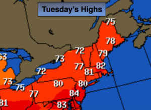
Tuesday:
Mostly sunny and cool. Highs in the lower 60s.
Keep it here for a no nonsense, no hype forecast.