Synopsis:
A very active early April pattern will be with us for the next week. Rapidly changing weather conditions are expected with a roller coaster ride in temperatures.
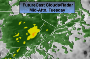
A warm front this morning over Central NJ will cause areas of morning fog and drizzle. The front may have a hard time moving North of the immediate NYC vicinity. Those areas that get into the warm sector will pop into the 60s. It will become windy ahead and behind the cold front. Gusts of 40-60mph are possible. High Wind Warnings and Advisories are up for the tri-state area. Thunderstorms may accompany the front that will move in from midday to mid afternoon. It will not be a washout with the sun returning during the afternoon.
Much colder readings will greet us on Thursday with readings only rising into the 40s.
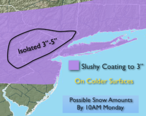
The latest computer models have an area of low pressure and front along the East coast on Saturday possibly affecting the region with a period of wet snow and or rain. The potential has increased some. At this time, it looks like the majority of the precipitation will fall during the day. How much, if any snow, will stick with the very high April sun angle. The snow of a couple days ago mainly fell at night. The sun had no affect on melting, hence the accumulating snow. This time around the high sun angle may play a huge part.
Stay tuned.
Today:
Areas of AM fog. Mostly cloudy with scattered showers and possibly a thunderstorm. It will not be raining all the time, in fact much of the day will be dry. Windy and warm. Highs in the 50s to the North, 60s from NYC and to the South. Southwest to West winds at 15-30mph with gusts to 40-60mph.
Tonight:
Clear, windy and much colder. Lows around freezing in the City, the 20s inland. West to Northwest winds at 15-30mph with gusts to 50mph early this evening. Winds will diminish overnight.
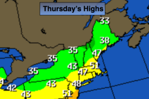
Thursday:
Partly sunny and colder. Highs in the mid 40s.
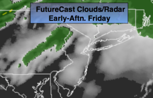
Friday:
Morning snow showers, otherwise mostly cloudy with scattered rain showers during the day. Highs in the lower to mid 50s.
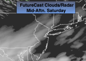
Saturday:
Chance of wet snow and or rain. Highs in the lower 40s.
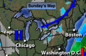
Sunday:
Mostly sunny. Highs in the mid 40s.
Keep it here for a no nonsense, no hype forecast.