Synopsis:
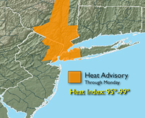
A heat wave will begin today a high pressure settles over the Eastern one third of the country. The heat should persist through midweek. The combination of temperatures over 90º and moderate levels of humidity will result in a heat index in the mid to upper 90s. For this reason, a Heat Advisory has been posted for the City and vicinity.
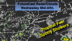
A cool front will move in by Wednesday with scattered showers and storms. Relief will arrive on Thursday. Temperatures and humidity levels will be lower.
Stay tuned.
Today:
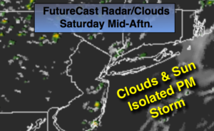
Sunny, hot and humid. Highs in the lower 90s. North winds becoming South at 5-10mph.
Tonight:
Clear, muggy and warm. Lows in the mid 70s in the City, the 60s to around 70º inland. South to Southwest winds 5mph.
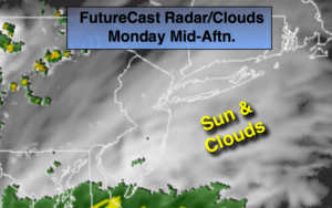
Monday:
Hazy, hot and humid. Highs in the lower 90s.
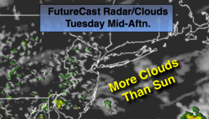
Tuesday:
Hazy, hot and humid. Highs in the lower 90s.
Wednesday:
Hazy, very warm and humid. Afternoon showers and storms. Highs in the upper 80s.
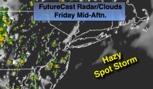
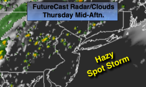
Thursday:
Party sunny, warm and much less humid. Highs in the mid 80s.
Keep it here for a no nonsense, no hype forecast.