Synopsis:
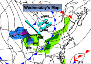
Below average temperatures will be with us once again as low pressure over Eastern Canada and high pressure to the West bring down a colder airmass. Gusty winds will add to the chill. A mix of sun and clouds is expected for today.
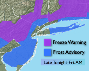
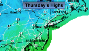
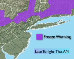
Thursday will be very cool with readings ten degrees below the average high of 60º as cold high pressure works in. A fine finish to the workweek is expected on Friday albeit chilly.
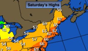
The potential has increased for a storm to ride up the East Coast on Saturday. First off, we are not looking at snow with this event (just want to make that clear). It can be classified as a Nor’easter, as strong Northeast winds will accompany the storm. A period of heavy rain is likely on Saturday, most likely occurring in the morning. The exact track and intensity will be determined how much rain and wind will occur.
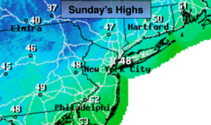
Sunday will be mostly cloudy with showers possible as lingering low pressure remains.
You know where to find a no hype, no nonsense forecast.
Stay tuned.
Today:
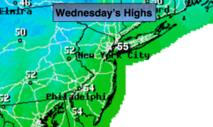
Partly sunny, breezy and cooler. Highs in the mid 50s. Northwest winds 15-30mph.
Tonight:
Clear and cold. Lows around 40º in the City, the 30s inland. Northwest wind diminishing to 5-15mph.
Thursday:
Partly sunny, breezy and colder. Highs near 50º.
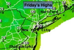
Friday:
Mostly sunny during the morning. High clouds will roll in during the afternoon. Chilly. Highs around 50º.
Saturday:
Rain, possibly heavy at times, especially in the morning. Strong gusty winds. Highs in the mid 40s.
Sunday:
Mostly cloudy. Scattered showers. Highs in the lower 50s.
Keep it here for a no nonsense, no hype forecast.