Synopsis:
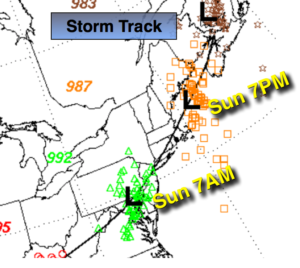
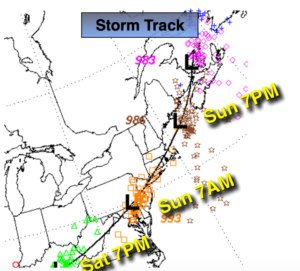
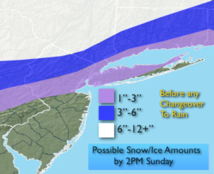
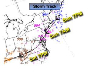
The storm that gave the area inland snow and ice and heavy rain will continue to intensify and move from near Philadelphia this morning to Eastern New England by later today.
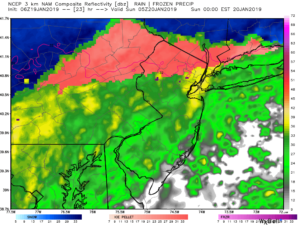
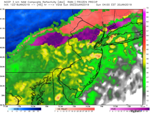
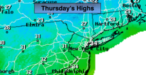
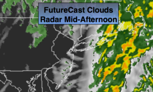
Areas of heavy precipitation will taper off this morning as the storm passes to the North and East. The sun will make an appearance (map above). High temperatures will be reached around midday. Those highs will range from the upper 20s well inland to the 50s South coastal areas.
A flash freeze is will occur as a push of Arctic air works in later this afternoon. All standing water or slush will freeze solid.
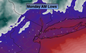
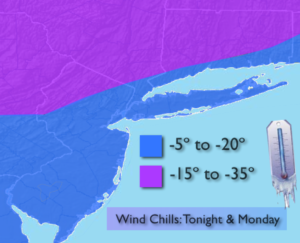
Temperatures will plummet to the single digits throughout the region tonight (map above) as a bitterly cold airmass works in from Canada. The wind will feel like a slap in the face and sting. Wind chill factors will be well below zero and reach -20º to -30º to the Northwest later tonight and tomorrow (map above). Wind Chill Advisories and Warnings are up for the entire tri-state area. Please cover all exposed skin if not it could become a dangerous situation. Dress in layers, that tends to deaden the air between the layers and in turn keep you warm.
Highs on Monday-Martin Luther King Jr. Day, will be only in the teens despite the sunshine. Winds will gust to 40mph.
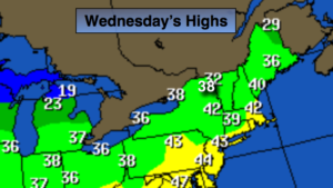
A January thaw is expected Wednesday into Thursday with showers likely.
You know where to find a no hype, no nonsense forecast.
Stay tuned.
Sunday:
Areas of heavy rain and freezing rain tapering off this morning. Readings in the 20s, 30s, 40s & 50s depending on location. Temperatures will plummet to the teens and 20s by evening. The sun will return. Southwest to Northwest winds increasing to 15-30mph.
Tonight:
Mostly clear, windy and bitterly cold. Lows in the single digits. Wind chills between -5º to -35º. Northwest winds at 15-30mph with gusts to 40mph.
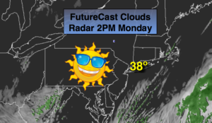
Monday:
Mostly sunny, windy and bitterly cold. Highs only in the lower to mid teens. Wind chills well below 0º.
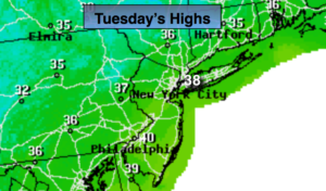
Tuesday:
Sunny and cold. Highs in the upper 20s.
Wednesday:
Mostly cloudy and much milder. Chance of showers. Highs in the mid 40s.
Thursday:
Mostly cloudy. Rain likely. Highs in the upper 40s.