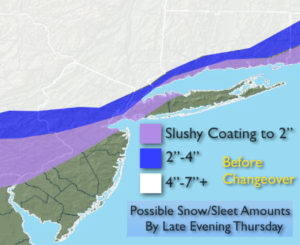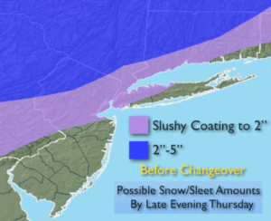
Synopsis:
An Arctic front will move through this evening with an isolated snow showers. A snow squall is possible especially North and West of the City. Visibility in a squall can go down to zero in heavy and blowing snow for a few minutes. A coating is possible where the squall occurs. Skies will then clear with reading plummeting into the mid to upper teens by late tonight.
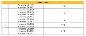
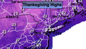
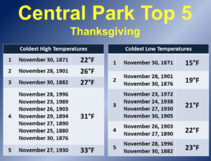
This front will allow the coldest airmass of the season to pour in from Canada on Thanksgiving. Highs on Thursday will remain in the mid to upper 20s. If the temperature dips to 19º at any point during Thursday in NYC; it’ll be go down as the second coldest Thanksgivings on record! The second graphic above shows the stats on the top five coldest Thanksgiving on record. We will definitely reach the top five coldest. At least the sun will shine.
Black Friday will be cold under sunny skies.
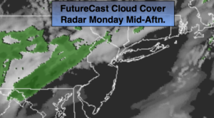
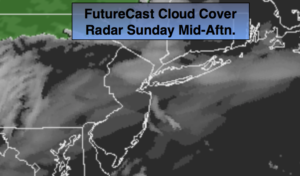
A low will trek out of the Southern states and toward the area later Saturday. Sun will give way to clouds. Rain is likely later Saturday afternoon and night. Sunday now l0oks to be dry under partly sunny skies as many travel home from their destination.
You know where to find a no hype, no nonsense forecast.
Stay tuned.
Tonight:
An isolated evening snow shower or squall, otherwise mostly clear, windy and frigid. Lows in the teens to around 20º to the South. Northwest 15-30mph. Wind chills in the single digits by morning.
Thanksgiving:
Sunny, breezy and frigid . Highs only in the mid to upper 20s. Northwest winds at 15-25mph with gusts to 30mph. Wind chills in the teens.
Friday:
Mostly sunny and cold. Highs around freezing.
Saturday:
Morning sun will give way to afternoon rain. Much milder. Highs in the lower 50s.
Sunday:
Partly sunny and mild. Highs in the mid 50s.
Monday:
Periods of rain. Highs around 50º.
Keep it here for a no nonsense, no hype forecast.