Synopsis:
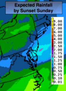
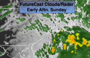
Low pressure developing over the area today will result in on and off which maybe moderate to heavy at times early on. The heaviest rain looks to fall along the coast where up to an inch or so may fall. The rain will taper off midday and the sun should make an appearance during the late afternoon. It’ll be mild by days end with highs reaching the 40s inland and the lower 50s at the coast.
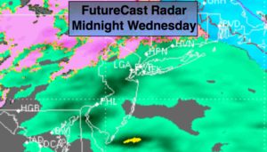
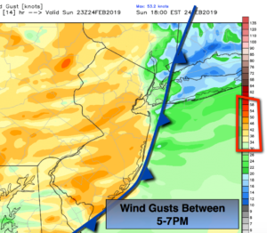
A High Wind Warning is in effect for the entire tri-state area for late this afternoon through Monday. Wind gusts from the West have the potential to gust to 60mph. . There will be two peak times to the high winds around sunset tonight with the passage of a very strong cold front (2nd map above shows winds gusting to 50mph+). The won’t be quite as strong overnight. The second peak will be of long duration-all day Monday.
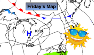
Why will it be so windy? Strong low pressure will be in Eastern Canada at the same time strong high pressure will be over the Northern Plains. The difference in pressure (the pressure gradient) will cause strong West winds that will possibly cause damage at peak intensity. Please secure any loose objects outdoors. They may not be there by tonight.
The winds will abate Tuesday. It’ll be tranquil and chilly through midweek. In fact, it looks quiet through Friday as high pressure influences our weather. Temperatures will be below average as the high remains to the North.
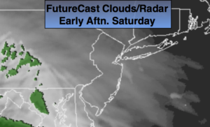
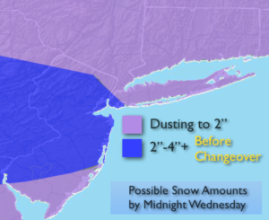
Another rain event looks to be on the way for Saturday as the pattern, like all Winter long, does not support a snowstorm.
Keep it here for a no nonsense, no hype forecast.
Today:
Rain likely through midday. Becoming partly sunny later in the day. Mild. Winds will increase dramatically toward sunset. Highs in the lower 50s. East to Southwest winds at 5-10mph. Increasing to West at 20-40mph with gusts to 60mph around sunset.
Tonight:
Partly cloudy, windy and much colder. Lows in the lower to mid 30s in the city, the upper 20s inland. West winds at 15-30mph with gusts to 40mph. Winds will gust up to 50mph late tonight.
Monday:
Partly Sunny and windy. Winds gusts to 60mph are possible. Highs in the lower 40s.
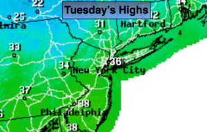
Tuesday:
Mostly sunny. Chilly. Highs in the mid 30s.
Wednesday:
Mostly sunny. Cold. Highs around freezing.
Thursday:
Sunny. Chilly. Highs in the upper 30s.