Synopsis:
The wicked winds of the last 24 hours will slowly diminish today. Strong low pressure in Eastern Canada will continue move farther away. This will cause the pressure gradient between that system and strong high pressure to the West to weaken resulting in slowly abating winds.
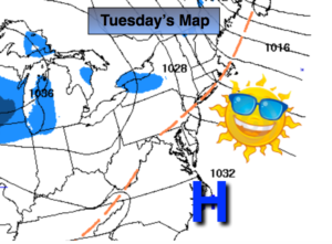
High pressure will move toward the East coast. Today will feature mainly sunny skies with readings just above freezing.
Late Wednesday afternoon into Wednesday night a weak low will move out of the Great Lakes into New England. There is the potential of a bit of light snow. The greatest chance will be North of the City. This is where a coating or so of snow may accumulate.
On Friday, another weak disturbance moving through may spark off a few snow showers or period of light snow. Again, not a big accumulation maker-another coating or so of snow in spots.
Another low will develop over the East coast on Saturday. It is model mayhem with this system. The GFS the track just to our West, the European has a the system off the coast and a colder solution. At this time, the call is in the middle with the potential of some rain or wet snow. Confidence in Saturday’s forecast is low at this time. Please check back to JMW for further updates.
Keep it here for a no nonsense, no hype forecast.
Today:
Mostly sunny, breezy and chilly. Highs in the mid 30s. Northwest winds at 15-25mph.
Tonight:
Becoming mostly cloudy.. Lows in the lower 20s in the city, the teens inland. West to Northwest winds diminishing to 5-10mph.
Wednesday:
Cloudy. The chance of a bit of light snow, especially North. Highs around freezing.
Thursday:
Clouds to sun. Chilly. Highs in the upper 30s.
Friday:
Mostly cloudy. Snow showers or a period of light snow is possible. Highs in the upper 30s.
Saturday:
Mostly cloudy. The potential exists for some rain and or wet snow. Highs around 40º.