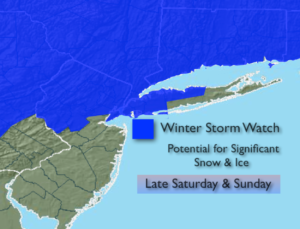
Synopsis:
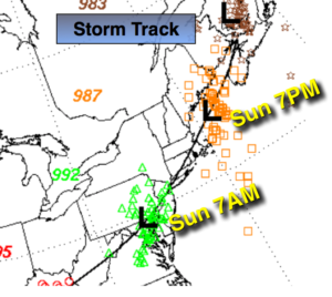
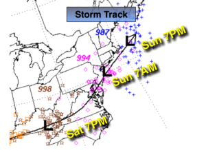
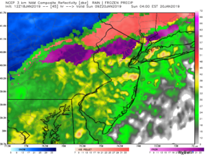
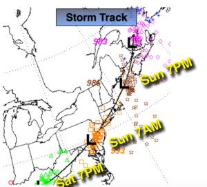
A storm with heavy precipitation will move toward the area this weekend. Any sun will give way to clouds this morning. Snow or a mix to the South should move in between 4pm-8pm from West to East. An accumulating heavy snow (a couple to several inches depending on location) is likely just inland and including the City before a mix occurs tonight. The latest computer guidance continues to suggests a warm slug of air will work in changing the snow over the rain along the coast and a mix of freezing rain, sleet and snow and rain inland. All of the latest computer guidance has a stronger storm, a warmer solution and a track that will kill the significant snowfall for NYC and the immediate vicinity. The storm moves from West Virginia to Southeastern PA to right over NYC by Sunday morning. (map above). This warmup will occur for about 8 hours into early Sunday morning.
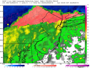
The 3kM NAM model (2nd map above) has warmed up as well. It also has the critical 32º mark (the thin red line over Northern NJ and to the East) farther North with the latest run.. This model does well a lot of the time with micro synoptic weather patterns. I cannot discount it. Icing is possible after the accumulating snow near this freezing line. Up to 1/4″ of ice is possible . Also heavy sleet will occur just North of the Freezing rain line. The legend of the colors of the precipitation type is at the bottom of the map. I cannot stress how 10 to 20 miles will make all the difference in the world between plain rain and serious ice. It’s called a coastal front along the area of low pressure. Where the wind stays more of a Northerly component-watch out.
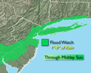
Flooding rains are possible where the precipitation stays liquid. One to two and half inches of liquid precipitation is expected.
A flash freeze is likely on Sunday as the push of Arctic air works in. Heavy rain for most areas with a mix inland will taper off within a few hours of midday. By the time the Arctic air reaches the coast most of the precipitation will have moved East, so the change back to snow has diminished considerably. The sun will most likely return on Sunday for a part of the afternoon.
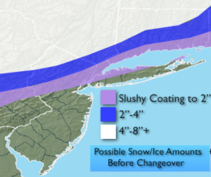
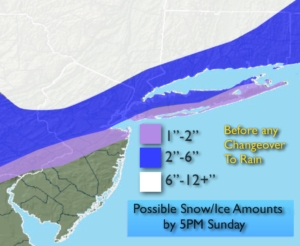
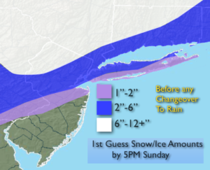
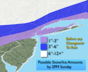
To recap: As of right now, it looks like a burst of moderate to heavy snow at the onset of the storm later today and into tonight for much of the area. A couple to several inches may accumulate around and to the North and West of the City. A significant snowfall is expected inland (possible snow amounts above, the amounts have been lowered since the last update). A mix over Southern sections. Then a transition to heavy rain along the coast with the potential of heavy freezing rain, sleet and snow inland into Sunday morning. This continues to be a fluid situation. JMW continues to monitor the latest information coming in.
You know where to find a no hype, no nonsense forecast.
Stay tuned.
Today:
Morning sun will give way to thickening clouds. Snow will move in during the afternoon or evening. A mix is possible over Southern areas. Highs in the mid 30s. Northeast to East winds at 8-12mph.
Tonight:
Snow, heavy at times inland for several hours than a transition over to a mix. Along the coast any mixed precipitation will go over to heavy rain. Lows in the 20s to around 30º inland. Temperatures rising into the 30s and 40s along the coast and to the South. East winds increasing to 10-20mph.
Sunday:
Heavy rain along the coast and Southern areas. Heavy freezing rain, sleet and snow inland. The heaviest precipitation will occur during the morning. Readings in the 20s, 30s & 40s depending on location. Temperatures will plummet to the teens and 20s later in the day. The sun will return for a portion of the afternoon.
Monday:
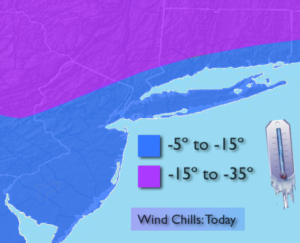
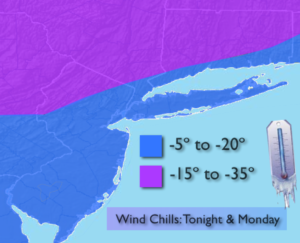
Partly sunny, windy and bitterly cold. Highs only in the lower teens. Wind chills near 0º.
Tuesday:
Sunny and cold. Highs in the upper 20s.
Wednesday:
Mostly cloudy and much milder. Chance of showers. Highs in the mid 40s.