Synopsis:
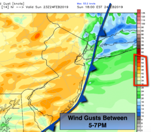
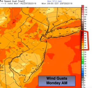
A High Wind Warning is in effect for the entire tri-state area through Monday. Wind gusts from the West have the potential to reach up to 60mph. There will be two peak times to the high winds. The first peak will occur between 9pm & Midnight behind the passage of a very strong cold front. The winds won’t be quite as strong during the wee hours of the morning. The second peak will be Monday Morning after sunrise through midday(map above). Weak rooted trees may come down and power outages are possible.
Highs winds will continue into the afternoon and slowly abate later in the day. A mix of sun and clouds is expected.
Why will it be so windy? Strong low pressure will be in Eastern Canada at the same time strong high pressure will be over the Northern Plains. The difference in pressure (the pressure gradient) will cause strong West winds that will possibly cause damage at peak intensity. Please secure any loose objects outdoors; you may never find them again.
The winds will relax Tuesday. It’ll be tranquil and chilly through midweek. In fact, it looks quiet through Thursday as high pressure influences our weather. Temperatures will be below average as the high remains to the North.
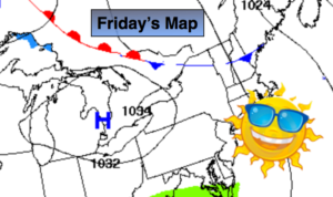
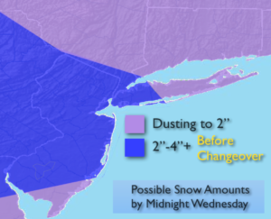
By Friday, a weak disturbance moving through may spark off a few snow showers. This doesn’t look to be a big deal.
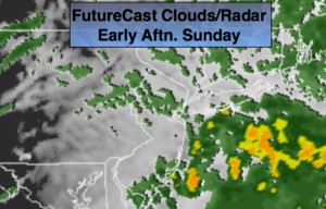
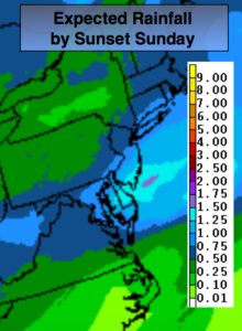
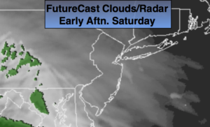
Another rain event looks to be on the way for Saturday as the pattern, like all Winter long, does not support a snowstorm. The storm track is to our West. A storm track just offshore is needed for a snow event.
Keep it here for a no nonsense, no hype forecast.
Tonight:
Partly cloudy, windy and much colder. Lows in the lower to mid 30s in the city, the upper 20s inland. West winds at 15-30mph with gusts to 50-60mph until midnight. The wind gusts will gust up to 45mph through the night.
Monday:
Partly Sunny and windy. Winds gusts to 60mph are possible, especially in the morning. Highs around 40º.
Tuesday:
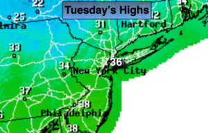
Mostly sunny, breezy and chilly. Highs in the mid 30s.
Wednesday:
Mostly sunny. Cold. Highs around freezing.
Thursday:
Mostly sunny. Chilly. Highs in the upper 30s.
Friday:
Mostly cloudy. Snow showers are possible. Highs in the upper 30s.