Synopsis:
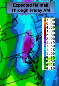
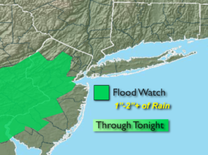
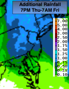
A storm will intensify over the Delmarva Peninsula this evening and move North to near New York City by early Friday morning. Rain will become steadier and heavier this evening and tonight as the storm moves over the region. It’ll be a Spring soaker. 1″-2″ of rain is quite possible with the jackpot zone over the interior. An additional inch or so of rain is expected from 7pm Thursday to 7am Friday (map above). A Flood Watch has been issued for parts of NJ.
The storm will move into New England on Friday and bomb. Any morning light rain will end, otherwise skies break for some peeks of sun. Winds will increase dramatically during the day and become strong. A few spotty showers of rain and or snow are possible with the upper level low moving through the region later in the day and during the evening.
The weekend will be precipitation free. It’ll be very windy and chilly on Saturday. Sunday will be the better half with much milder readings with winds relaxing. Both days will feature sun.
The beginning of the week tranquil as an area of low pressure slides to the South. Rain and snow will not affect the region with this system.
Keep it here for a no nonsense, no hype forecast.
Tonight:
Rain, heavy at times. Lows in the lower 40s in the City, the 30s to around 40º inland. East winds become Northwest toward morning at 15-25mph and diminishing late.
Friday:
Early morning rain otherwise, becoming partly cloudy and becoming windy. Spotty showers of rain and or snow are possible during the afternoon. Highs near 50º. Temperatures will fall during the late afternoon. Winds increasing to 15-30mph with gusts to 40mph later in the day.
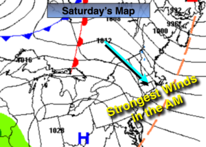
Saturday:
Partly sunny, windy and chilly. Highs in the lower 40s. Wind gusts up to 50mph.
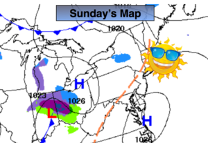
Sunday:
Mostly sunny and milder. A much better feel. Highs in the mid to upper 50s.
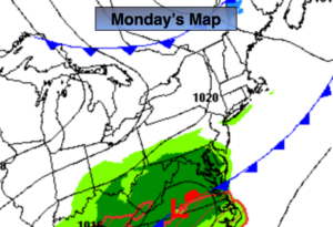
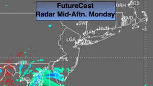
Monday:
Partly sunny, mild. Chance of late day showers. Highs in the mid 50s.
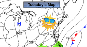
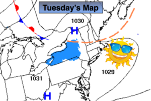
Tuesday:
Mostly sunny. Much cooler. Highs in the lower 40s.